Trip Details

  • Destination: Nepal
  • Trip Difficulty: Very Strenuous
  • Trip Style: Active Adventure
  • Transport: Private Vehicle & Flight
  • Food: Breakfast, Lunch & Dinner
  • Accommodation: Teahouse or Lodge
  • Group Size: 1 - 16
  • Max Elevation: 6189m

Highlights

  • Cross 3 mountain passes of the Everest region.
  • A thrilling flight to Lukla.
  • Explore the mountaineering museum in Namche Bazaar.
  • Visit the largest monastery in the Everest region- Tengboche Monastery.
  • Astonishing views of the Khumbu and Ngozumpa glacier from EBC.
  • Trek to the Base Camp of the tallest mountain in the world.
  • Visit the highest freshwater lake system in the world- Gokyo Lakes.
  • Mesmerizing sunrise views from Kala Patthar. 
  • Summit the Island Peak (6189m)
  • Island Peak Base Camp (Pareshaya Gyab)
  • Island Peak also is known as Imja Tse
  • Imja Tsho (5010m)
  • Amphu Labste Tsho (4985m)
  • Good view of Mt. Ampulapcha (5663m), Mt. Makalu (8481m), Mt. Ama Dablam (6812m)
  • Lhotse Glacier

Description

Everest Base Camp Trek is a trekking paradise. The charming views of the mountains as well as the chance to experience the Sherpa culture is a dream of many people. However, there is much more to the Everest region than just the Everest Base Camp. You can experience all the beauty of the Everest region in the 3 passes trek of the Everest region.

Everest 3 passes trek by Mount Mania takes you to the mountain passes of the Everest region including Renjo La Pass, Kongma La Pass, and Cho La pass. All of these mountain passes excellent vantage points to see the various mountains of this region. 

You will get excellent views of the 8000-meter tall mountains like Everest, Lhotse, Nuptse, Ama Dablam, Co Oyu etc. The best places to see the glory of all these mountains are Kala Patthar and Tengboche. The best places to catch the sunrise views amidst the mountains of the Everest region are also these two places. 

You will also go to the Gokyo Valley during this Everest Three High Passes trek by Mount Mania. Gokyo Valley, with its astonishing landscape and the various beautiful lakes, is perhaps the most scenic valley in Nepal. 

The Everest Three Passes by Mount Mania lasts 17 days including your arrival and departure in Kathmandu. You will trek for a total of 14 days including the acclimatization days you will spend in Namche Bazaar and Gokyo.

No great reward comes without some pain. In a similar way, the Everest Three Passes trek by Mount Mania is also one of the most strenuous treks in the Everest region. This is due to the fact that there are a great number of uphill trails you will encounter along the way. 

However, if you maintain a good level of fitness, you will experience the unparalleled beauty of the Everest region in this trek.

Everest Three Passes Trek by Mount Mania is an adventurous trip to the beauty of the Everest region. The wonderful landscape, hospitable people along the way, the challenges of trekking along the way will give you an adrenaline rush like no other trek in the Everest region. 

Island Peak Climbing is one of the main climbing peaks in the Everest Region of Nepal with an impressive and highly glaciated West Face that rises from the Lhotse Glacier. It is situated in Sagarmatha National Park of the Himalayas of eastern Nepal.

The peak was named Island Peak in 1951 by Eric Shipton’s party since it appears as an island in a sea of ice when viewed from Dingboche. It is designed for energetic and physically fit trekkers with little or no experience in mountain expedition.

18 Days Everest Three Passes with Island Peak Climbing Itinerary

Expand AllHide All

You will take a 35-minutes morning flight to Lukla. The flight to Lukla is one of the most scenic as you will get to see some glorious views of the Himalayas. Lukla airport is also one of the most dangerous airports in the world. So, you will have an exciting flight. After you land in Lukla, you will meet your guide and porter.

After a short break, you will begin your trek. The beginning of your trek is relatively easy as you trek past Chaurikharka village. Then, you will descend towards Thadokoshi to Ghat (2530 meters). The trekking trail will then follow the banks of Dudh Kosi river. After trekking for 3-4 hours from Lukla, you will eventually reach Phakding (2652 meters), where you will spend your night. Phakding has a wonderful vibe and good teahouses. 

  • Meals: Breakfast, Lunch, Dinner
  • Accommodation: Tea House
  • Distance: 30 minutes flight / 7km / 3-4 hrs
  • Altitude: 2650m

You will enjoy a pleasant morning breakfast in Phakding. You will gear up for your trek ahead. You leave the biggest Sherpa village Namche (3,440m\11,286ft) behind. You will cross over Dudh Koshi River via a long suspension bridge. The trail will continue through the cool pine forest for two hours. You will arrive at Monjo, the entrance to Sagarmatha National Park. You will stop for a brief moment here.

Entry Permits will go through inspection at this stop. After a short descend to Dudh Kosi River, you will have your lunch at Jorsale. You will continue your hike to Namche after an adequate amount of lunch. The trails will pass through the Khumbu region. You will cross the Hillary Suspension Bridge. After crossing the Highest suspension bridge of Khumbu region.

You will have the first glimpse of Mount Everest 8,848 m (29,029 ft) from Top Danda. You will continue your trek for an hour and arrive at Namche Bazaar for night stay. – One and only gateway to Everest. You will spend 5-6 hours hiking to Namche. So, it's wise to rest your body at the gateway to Everest Base Camp 5,364m/17,598ft.

  • Meals: Breakfast, Lunch, Dinner
  • Accommodation: Tea House
  • Distance: 11km / 5-6 hrs
  • Altitude: 3440m

The next day you will set off for a hike. The hike is necessary for your body to acclimatize and adapt to the environment. You will hike to Everest View Hotel at an altitude of (3880m\12729ft). You will have breathtaking views of Mt. Everest 8,848 m (29,029 ft), Mt. Amadablam (6,812 m\22,349 ft), Mt.Lhotse (8516m\27939ft). You will hike for 4-5 hours for your body to acclimatize.

This day hike will speed up your acclimatization process for the trek to Everest Base Camp. The hike today lasts for 4-5 hours. You will explore the Sherpa museum. You will have an insight about the Sherpa culture. You will learn about the Sherpa history of mountaineering. Haat Bazar is a part of Namche Bazar. It will open for trading on Saturday. It is a Hotspot filled with trekking and mountaineering clothing and gears. You will have to withdraw or exchange your currency here at Namche Bazaar. It is the last stop to provide such facilities.

  • Meals: Breakfast, Lunch, Dinner
  • Accommodation: Tea House
  • Distance: 3- 4 hrs
  • Altitude: 3440m

The journey from Namche Bazaar to Thame in the Everest region of Nepal offers a breathtaking adventure through rugged terrain, ancient trails, and stunning Himalayan vistas. Starting from Namche Bazaar, a bustling Sherpa town nestled amidst towering peaks, the trail winds through valleys and ascends gradually towards the village of Thame, located northwest of Namche.

Leaving Namche Bazaar, trekkers typically follow the path westward, tracing the Dudh Koshi River upstream. The trail initially climbs through pine forests and occasional meadows, offering occasional glimpses of Mt. Everest and its neighboring giants. As you ascend, the air thins and the landscape becomes more rugged, marked by rocky outcrops and alpine vegetation.

After a few hours of trekking, the village of Thamo appears on the horizon, with its picturesque stone houses and terraced fields. Thamo is a charming village known for its serene atmosphere and traditional Sherpa culture. Many trekkers stop here for a break or even overnight before continuing on to Thame.

From Thamo, the trail continues northwards, gradually gaining altitude as it follows the Bhote Koshi River valley. The views become increasingly dramatic, with snow-capped peaks looming closer. Trekkers pass through small hamlets and yak pastures, where locals tend to their livestock against the backdrop of towering mountains.

Finally, after about 4-5 hours of trekking from Namche Bazaar, the village of Thame comes into view. Thame is renowned not only for its stunning location beneath the towering Kongde Ri peak but also for its rich cultural heritage. It is the birthplace of many famous Sherpa climbers, including Tenzing Norgay, the first person to summit Everest with Sir Edmund Hillary.

In Thame, trekkers can explore the historic Thame Gompa (monastery), which dates back several centuries and holds significant religious and cultural importance for the Sherpa community. The monastery offers insight into Tibetan Buddhism and is adorned with intricate murals, statues, and prayer flags.

Beyond the monastery, Thame offers several trekking opportunities for those looking to explore further into the high Himalayas. Nearby attractions include the Renjo La Pass, a high-altitude pass that offers stunning panoramic views of Everest, Cho Oyu, and other peaks.

Overall, the trek from Namche to Thame is not just a physical journey but a cultural and spiritual experience, where trekkers can immerse themselves in the natural beauty and rich Sherpa heritage of the Everest region.

  • Meals: Breakfast, Lunch, Dinner
  • Accommodation: Tea House
  • Distance: 9km / 5-6 hrs
  • Altitude: 3820m

The trek from Thame to Lungden in the Everest region of Nepal continues to offer stunning vistas and a deep immersion into the Sherpa culture and Himalayan landscape. Starting from the picturesque village of Thame, nestled beneath towering peaks and surrounded by lush greenery, the trail leads further into the heart of the Himalayas, towards the remote village of Lungden.

Leaving Thame, trekkers head northwards, following the Bhote Koshi River upstream. The trail initially ascends gradually, passing through yak pastures and small Sherpa settlements. The landscape transitions from green valleys to rocky terrain as trekkers gain altitude. Along the way, breathtaking views of the surrounding peaks, including Thamserku, Kongde Ri, and Kusum Kanguru, provide constant companionship.

After a few hours of trekking, the trail reaches Marlung, a small settlement where trekkers can rest and enjoy refreshments. Marlung is known for its traditional Sherpa houses and warm hospitality, offering a glimpse into rural mountain life.

Continuing north from Marlung, the trail begins to climb more steeply towards Lungden. As trekkers ascend, the air becomes thinner, and the landscape becomes increasingly barren and rugged. The path winds through rocky slopes and patches of alpine vegetation, with occasional glimpses of snow-capped peaks in the distance.

After approximately 4-5 hours of trekking from Thame, Lungden comes into view. Situated at an elevation of around 4,350 meters (14,270 feet), Lungden is a small, remote village surrounded by towering peaks. The village is primarily inhabited by Sherpas who lead a traditional lifestyle centered around farming, herding yaks, and trading with neighboring villages.

In Lungden, trekkers can find basic accommodation and dining options, usually in the form of teahouses run by local Sherpa families. The village offers a serene atmosphere and a chance to experience the tranquility of the high Himalayas away from the more frequented trails.

From Lungden, adventurous trekkers often continue further into the high-altitude regions of the Everest region, exploring passes such as the Renjo La Pass (5,360 meters / 17,585 feet) or the neighboring valleys and lakes. These areas offer stunning views of Everest and neighboring peaks, as well as opportunities for solitude and reflection in the midst of pristine natural beauty.

Overall, the trek from Thame to Lungden is a journey through both physical and cultural landscapes, where trekkers can immerse themselves in the rugged beauty of the Himalayas while experiencing the rich Sherpa heritage that has thrived in these remote mountains for centuries.

  • Meals: Breakfast, Lunch, Dinner
  • Accommodation: Tea House
  • Distance: 8.5km / 5-6 hrs
  • Altitude: 4370m

Lungden Village, nestled in the lap of the Himalayas, stands as a testament to the raw beauty and serene simplicity of rural Nepal. Situated in the Solukhumbu District, at an elevation of over 3,000 meters (10,000 feet), Lungden is a small settlement that embodies the spirit of traditional Sherpa culture and mountain living.

The village is strategically located along the popular Three Passes trekking route in the Everest region, making it a significant stopover for trekkers and climbers en route to Everest Base Camp or traversing the high-altitude passes like Renjo La, Cho La, and Kongma La. Despite its remote location, Lungden offers basic amenities for trekkers such as teahouses and lodges, providing essential shelter and meals amidst the rugged terrain.

Lungden's architecture reflects its Himalayan heritage, with stone houses topped by intricately thatched roofs, designed to withstand the harsh mountain climate. Prayer flags flutter in the wind, sending blessings across the village, while the surrounding peaks, including the majestic Cho Oyu and Ama Dablam, provide a breathtaking backdrop to daily life.

Life in Lungden revolves around agriculture and livestock, with the villagers practicing subsistence farming and raising yaks and goats. The harsh climate limits the variety of crops that can be cultivated, but hardy grains like barley and potatoes thrive in these conditions. Traditional Sherpa culture remains strong here, evident in their unique festivals, religious rituals, and the warmth with which visitors are welcomed into their homes.

The natural surroundings of Lungden are a haven for biodiversity, with rare Himalayan flora and fauna dotting the landscape. The nearby Dudh Koshi River rushes through the valley, offering a source of water and vitality to the villagers and sustaining a variety of wildlife.

Visiting Lungden offers travelers a chance to experience the untouched beauty of the Himalayas, away from the more commercialized routes. The village provides a glimpse into a way of life that has endured for centuries, shaped by the challenges and rewards of living in such a remote and stunning environment.

In essence, Lungden Village stands as a beacon of resilience, culture, and natural splendor in the heart of the Everest region, inviting adventurers and cultural enthusiasts alike to witness and appreciate its unique charm.

  • Meals: Breakfast, Lunch, Dinner
  • Accommodation: Tea House
  • Distance: 2/3 hrs
  • Altitude: 4370m

Trekking from Lungden to Gokyo via Renjo La Pass is a challenging and scenic adventure that offers trekkers an alternative route to explore the breathtaking landscapes of the Everest region in Nepal. Here’s an overview of what this trek entails:

Route Overview:

Starting Point - Lungden: Lungden is a small village located in the remote Solukhumbu District, known for its traditional Sherpa culture and stunning mountain vistas. The trek typically begins from Lungden after acclimatization and preparation.

Trek to Renjo La Pass (5360m): From Lungden, the trail ascends gradually towards Renjo La Pass, passing through rugged terrain, yak pastures, and scattered stone houses. The climb to Renjo La Pass is demanding due to its high altitude, but the views along the way are rewarding. Trekkers can enjoy panoramic vistas of snow-capped peaks, including Everest, Cho Oyu, and others.

Renjo La Pass: At 5360 meters (17,585 feet), Renjo La Pass offers a dramatic viewpoint with unparalleled views of the surrounding Himalayan peaks and glaciers. It’s a perfect spot for trekkers to take a breather and soak in the majestic scenery before descending into the Gokyo Valley.

Descent to Gokyo: After crossing Renjo La Pass, the trail descends steeply into the serene Gokyo Valley. This area is famous for its series of glacial lakes, notably the pristine Gokyo Lakes, which are known for their striking turquoise color against the backdrop of towering peaks.

Gokyo: The village of Gokyo, located at the edge of the largest of the Gokyo Lakes (Dudh Pokhari), serves as a hub for trekkers exploring the region. Trekkers can rest here, acclimatize further, and enjoy optional side hikes such as ascending Gokyo Ri (5357m), which offers panoramic views of Everest, Lhotse, Makalu, and Cho Oyu.

Highlights of the Trek:

Scenic Beauty: The trek from Lungden to Gokyo via Renjo La Pass showcases some of the most spectacular landscapes in the Everest region. Trekkers traverse through diverse terrain, from barren high-altitude slopes to glacial valleys adorned with vibrant prayer flags.

Cultural Experience: Along the way, trekkers pass through Sherpa villages like Marlung and Phortse Thanga, where traditional Sherpa culture and hospitality can be experienced firsthand. Local monasteries, prayer wheels, and stupas dot the landscape, offering glimpses into the spiritual life of the Sherpa people.

Wildlife and Nature: The region is rich in biodiversity, with opportunities to spot Himalayan wildlife such as Himalayan Thar, musk deer, and various species of birds. The Ngozumpa Glacier, the largest in Nepal, adds to the dramatic natural scenery of the area.

Difficulty and Preparation:

Altitude: Renjo La Pass is one of the high-altitude passes in the Everest region, so proper acclimatization is essential. Trekkers should be prepared for altitude-related challenges and should spend adequate time acclimatizing in villages like Lungden and Gokyo.

Fitness: The trek involves several days of hiking at high altitude, so a good level of physical fitness and prior trekking experience is recommended. The terrain can be challenging, particularly around Renjo La Pass, where steep ascents and descents are encountered.

Permits: Trekkers need permits (Sagarmatha National Park Entry Permit and TIMS card) which can be obtained in Kathmandu or locally in Lukla.

Conclusion:

Trekking from Lungden to Gokyo via Renjo La Pass offers a unique and adventurous route through the heart of the Everest region. It combines breathtaking scenery, cultural immersion, and the challenge of high-altitude trekking, making it a memorable experience for trekkers seeking to explore Nepal’s Himalayan wilderness.

  • Meals: Breakfast, Lunch, Dinner
  • Accommodation: Tea House
  • Distance: 14km / 7-8 hrs
  • Altitude: 4700m

The views from Rokyo Ri are among the most spectacular in the Himalayas, offering panoramic vistas that capture the majesty and grandeur of some of the world's highest peaks. Here are some highlights of the views you can expect from Rokyo Ri:

1. Mount Everest (8,848 meters)

View: From Rokyo Ri, you can see the iconic summit of Mount Everest, the highest mountain in the world. The view provides a unique perspective of Everest's western face and the sprawling Khumbu Icefall.

Highlight: The sunrise or sunset over Everest, with the mountain bathed in golden light, is a sight to behold.

2. Lhotse (8,516 meters)

View: Lhotse, the fourth highest mountain in the world, is visible to the south of Everest. Its impressive south face dominates the skyline.

Highlight: The sheer rock walls of Lhotse stand out prominently, especially in the early morning or late afternoon light.

3. Makalu (8,485 meters)

View: Makalu, the fifth highest mountain in the world, can be seen further to the southeast. Its distinctive pyramid shape is easily recognizable.

Highlight: Makalu's sharp, isolated summit is particularly striking against the clear Himalayan sky.

4. Cho Oyu (8,188 meters)

View: Cho Oyu, the sixth highest mountain in the world, lies to the west of Everest. Its broad, expansive summit plateau is clearly visible.

Highlight: The view of Cho Oyu is often complemented by the Gokyo Lakes in the foreground, creating a stunning contrast between the turquoise waters and the snow-capped peak.

5. Gokyo Lakes

View: The series of high-altitude lakes, collectively known as the Gokyo Lakes, lie at the base of Rokyo Ri. These pristine, turquoise-blue lakes are among the highest freshwater lake systems in the world.

Highlight: The reflection of the surrounding peaks in the clear waters of the Gokyo Lakes adds an ethereal beauty to the landscape.

6. Ngozumpa Glacier

View: The Ngozumpa Glacier, one of the largest glaciers in the Himalayas, stretches out below Rokyo Ri. Its massive ice field is a reminder of the region's glacial power.

Highlight: The glacier's crevasses and ice formations are best seen from the heights of Rokyo Ri, offering a bird's-eye view of this dynamic landscape.

7. Surrounding Peaks and Ridges

View: In addition to the major peaks, Rokyo Ri offers views of numerous lesser-known but equally impressive mountains and ridges in the Khumbu region.

Highlight: The intricate patterns of ridges, valleys, and smaller peaks provide a complex and fascinating topography that changes with the shifting light.

8. Sunrises and Sunsets

View: The high altitude and clear skies of Rokyo Ri make it an ideal spot for observing sunrises and sunsets. The play of light and shadow on the mountains creates dramatic and ever-changing vistas.

Highlight: The first light of dawn illuminating the peaks, or the alpenglow at sunset, when the mountains turn pink and orange, is a truly magical experience.

Climbing Rokyo Ri for these views is a strenuous but rewarding experience, providing trekkers with unforgettable memories of the Himalayan landscape's beauty and majesty.

  • Meals: Breakfast, Lunch, Dinner
  • Accommodation: Tea House
  • Distance: 5 km / 3-4 hrs
  • Altitude: 4700m

The trek from Gokyo to Thangna (also known as Dragnag) is a scenic and adventurous journey in the Everest region of Nepal. This route is part of the famous Everest Base Camp trek via the Gokyo Lakes and the Cho La Pass. Here’s a detailed guide on what to expect during this trek:

Starting Point: Gokyo

Elevation: Approximately 4,790 meters (15,715 feet)

Highlights: Gokyo is known for its stunning turquoise lakes, the panoramic views from Gokyo Ri, and the dramatic Ngozumpa Glacier.

Trekking Route and Terrain

1. Departure from Gokyo:

Starting the Day: The trek begins early in the morning to take advantage of the clear weather and to ensure ample time for crossing the Cho La Pass.

Ngozumpa Glacier Crossing: Shortly after leaving Gokyo, trekkers traverse the Ngozumpa Glacier, the longest glacier in the Himalayas. This part of the trek involves walking on a mix of ice, rock, and moraine debris. The path can be uneven and challenging, so careful footing is required.

2. Trail to Thangna:

Route: The trail to Thangna follows the eastern side of the glacier. It is a relatively short distance but can be tough due to the rough terrain and the altitude.

Elevation Change: The trek from Gokyo to Thangna is relatively gentle in terms of elevation gain, with Thangna being at approximately 4,700 meters (15,420 feet).

Scenery: Trekkers are treated to magnificent views of surrounding peaks, including Cholatse and Taboche. The landscape is rugged, with dramatic mountain vistas and glacial formations.

Thangna (Dragnag)

Elevation: Approximately 4,700 meters (15,420 feet)

Features: Thangna is a small settlement primarily serving trekkers who are either coming from or heading towards the Cho La Pass. It consists of a few teahouses and lodges providing basic accommodations and meals.

Rest and Acclimatization: Trekkers often use Thangna as a base to rest and acclimatize before attempting the challenging Cho La Pass the next day.

Tips for Trekkers

Acclimatization: Proper acclimatization is crucial to avoid altitude sickness. Trekkers should take their time and stay hydrated.

Physical Fitness: The trek involves demanding sections, especially crossing the glacier, so good physical fitness is important.

Equipment: Proper trekking gear, including sturdy boots, warm clothing, and trekking poles, is essential. Crampons may be useful depending on the condition of the glacier.

Guides and Porters: Hiring a guide and porter can enhance the trekking experience, providing support and local knowledge.

Highlights and Challenges

Highlights:

- Spectacular views of the Himalayan peaks and glaciers.

- The experience of walking on the Ngozumpa Glacier.

- The serene beauty of the Gokyo Lakes and the rugged charm of Thangna.

Challenges:

- Navigating the rough and uneven terrain of the glacier.

- Dealing with the high altitude and its effects on the body.

- The potential for rapidly changing weather conditions in the mountains.

Next Steps

From Thangna, trekkers usually continue their journey towards the Cho La Pass (5,420 meters or 17,782 feet), eventually leading to the Khumbu Valley and the Everest Base Camp. The trek from Gokyo to Thangna is an essential and memorable part of this adventure, offering both challenges and breathtaking rewards.

  • Meals: Breakfast, Lunch, Dinner
  • Accommodation: Tea House
  • Distance: 15km / 8-9 hrs
  • Altitude: 4,830 m

The trek from Dzongla to Lobuche is a relatively short but picturesque segment of the Everest Base Camp trek. It provides trekkers with breathtaking views of some of the most iconic Himalayan peaks. Here’s an overview of what to expect:

Starting Point: Dzongla

Elevation: Approximately 4,830 meters (15,846 feet)

Highlights: Dzongla is a small settlement with a few teahouses offering basic accommodation and meals. It is often used as a resting point after crossing the challenging Cho La Pass.

Trekking Route and Terrain

1. Dzongla to Lobuche:

- Distance: Approximately 8-9 kilometers (5-6 miles)

- Duration: 3-4 hours

- Elevation Change: From 4,830 meters (15,846 feet) to 4,940 meters (16,210 feet)

- Description: The trail from Dzongla to Lobuche is relatively easy compared to the previous days’ challenges. It involves gradual ascents and descents with stunning views along the way.

Detailed Itinerary

1. Leaving Dzongla:

- Morning Departure: Trekkers typically start early to take advantage of the clear morning skies and to reach Lobuche by midday.

- Trail Conditions: The trail initially follows a gentle descent with views of Cholatse (6,440 meters) and Taboche (6,367 meters) dominating the skyline.

2. Scenic Walk:

- Terrain: The path meanders through rocky terrain and alpine meadows. The trail is well-defined and less strenuous compared to the Cho La Pass.

- Views: Trekkers can enjoy panoramic views of peaks like Ama Dablam (6,812 meters) and the surrounding landscapes. The Pheriche Valley can also be seen in the distance.

3. Arrival in Lobuche:

- Elevation Gain: The trail involves a gradual ascent towards Lobuche, which lies in the Khumbu Valley.

- Lodging: Lobuche is a larger settlement compared to Dzongla, with several teahouses offering accommodation, food, and basic amenities. It serves as a major stopover for trekkers heading to Everest Base Camp.

Highlights and Tips

- Scenic Beauty: The trek offers magnificent views of some of the most famous peaks in the Everest region, making it a visually rewarding journey.

- Easier Terrain: After the challenging crossing of the Cho La Pass, this segment is relatively easier, allowing trekkers to recover and enjoy the scenery.

- Acclimatization: Lobuche is a crucial acclimatization stop before heading towards higher elevations like Gorak Shep and Everest Base Camp.

- Physical Fitness: While this segment is less demanding, it’s important to maintain a steady pace and stay hydrated.

Lobuche

- Elevation: Approximately 4,940 meters (16,210 feet)

- Features: Lobuche is a key stopping point on the way to Everest Base Camp and Kala Patthar. It offers several teahouses, lodges, and basic facilities for trekkers.

- Next Steps: From Lobuche, trekkers typically continue to Gorak Shep (5,164 meters) and then to Everest Base Camp (5,364 meters), with an optional hike to Kala Patthar (5,545 meters) for sunrise views over Everest.

The trek from Dzongla to Lobuche is a memorable part of the Everest Base Camp trek, providing trekkers with spectacular views, a chance to acclimatize, and the anticipation of getting closer to the ultimate goal of reaching Everest Base Camp.

  • Meals: Breakfast, Lunch, Dinner
  • Accommodation: Tea House
  • Distance: 6km / 5-6 hrs
  • Altitude: 4930m

The trek from Lobuche to Gorak Shep, followed by the hike to Everest Base Camp (EBC) and the return to Gorak Shep, is one of the most exciting and rewarding segments of the Everest Base Camp trek. This journey takes you through some of the most iconic landscapes in the Himalayas, offering breathtaking views and the sense of achievement of reaching the base of the world's highest peak.

Starting Point: Lobuche

- Elevation: Approximately 4,940 meters (16,210 feet)

- Highlights: Lobuche serves as a key acclimatization stop with several teahouses providing accommodation and meals.

Trekking Route and Terrain

1. Lobuche to Gorak Shep:

- Distance: Approximately 4.5 kilometers (2.8 miles)

- Duration: 2-3 hours

- Elevation Change: From 4,940 meters (16,210 feet) to 5,164 meters (16,942 feet)

- Description: The trail from Lobuche to Gorak Shep is a gradual ascent through a rocky and rugged terrain, with stunning views of the surrounding peaks.

2. Gorak Shep to Everest Base Camp:

- Distance: Approximately 3.5 kilometers (2.2 miles) one way

- Duration: 2-3 hours to EBC, 1.5-2 hours back to Gorak Shep

- Elevation Change: From 5,164 meters (16,942 feet) to 5,364 meters (17,598 feet)

- Description: The hike to Everest Base Camp is a challenging trek over rocky moraine and glacial paths. The trail is well-marked but requires careful navigation.


Highlights:

- Achieving the goal of reaching Everest Base Camp.

- Stunning views of the Khumbu Icefall, Nuptse, and other peaks.

- The unique experience of walking on glacial moraine.

- Challenges:

- High altitude, with potential for altitude sickness.

- Rough and rocky terrain requiring careful navigation.

- Cold and windy conditions, especially at higher elevations.

Tips for Trekkers

- Acclimatization: Spend enough time acclimatizing in Lobuche and Gorak Shep to minimize the risk of altitude sickness.

- Hydration and Nutrition: Drink plenty of water and eat energy-rich foods to maintain stamina.

- Pacing: Take it slow and steady to conserve energy and manage the altitude.

- Proper Gear: Wear appropriate clothing layers, good trekking boots, and carry necessary supplies like water, snacks, and a first aid kit.

Next Steps

After spending the night in Gorak Shep, many trekkers hike to Kala Patthar (5,545 meters or 18,192 feet) early the next morning for the best sunrise views over Everest and then return to Gorak Shep before heading back down the valley towards Pheriche or Dingboche.

The trek from Lobuche to Gorak Shep and the hike to Everest Base Camp is a highlight of the Everest region, offering an unparalleled adventure in the heart of the Himalayas.

  • Meals: Breakfast, Lunch, Dinner
  • Accommodation: Tea House
  • Distance: 15km / 7-8 hrs
  • Altitude: 5180m

The early morning hike to Kala Patthar and the subsequent trek down to Lobuche is one of the most exhilarating and rewarding parts of the Everest Base Camp trek. This journey offers unparalleled views of Mount Everest and surrounding peaks, making it a highlight for many trekkers.

Early Morning Hike to Kala Patthar

- Starting Point: Gorak Shep

- Elevation: Approximately 5,164 meters (16,942 feet)

- Destination: Kala Patthar

- Elevation: Approximately 5,545 meters (18,192 feet)

- Distance: Approximately 1.5 kilometers (0.9 miles) one way

- Duration: 2-3 hours to ascend, 1-1.5 hours to descend

The Ascent to Kala Patthar

1. Early Start:

- Departure Time: Trekkers usually start very early, often around 4-5 AM, to catch the sunrise from the summit.

- Preparation: Dress warmly in layers as the early morning temperatures can be extremely cold, and carry a headlamp for the initial dark ascent.

2. Trail Conditions:

- Terrain: The trail is steep and rocky, requiring a steady pace and careful footing. The higher altitude makes the climb challenging, and trekkers should be mindful of their breathing and take breaks as needed.

- Scenery: As dawn breaks, the views start to unfold with the peaks bathed in the first light of day.

3. Reaching the Summit:

- Summit Views: At the top of Kala Patthar, trekkers are rewarded with spectacular panoramic views of Mount Everest, Nuptse, Lhotse, and the surrounding Himalayan giants. The sight of Everest from Kala Patthar is often considered one of the best views in the world.

- Photography: This is a prime spot for taking memorable photographs of the Everest region.

The Descent to Gorak Shep

- Return Journey: After spending some time at the summit, trekkers make their way back down to Gorak Shep. The descent is quicker but still requires caution due to the steep and rocky path.

- Breakfast: Upon returning to Gorak Shep, trekkers typically have breakfast and rest briefly before starting the trek down to Lobuche.

Trek Down to Lobuche

- Starting Point: Gorak Shep

- Elevation: Approximately 5,164 meters (16,942 feet)

- Destination: Lobuche

- Elevation: Approximately 4,940 meters (16,210 feet)

- Distance: Approximately 4.5 kilometers (2.8 miles)

- Duration: 2-3 hours

The Route to Lobuche

1. Leaving Gorak Shep:

- Trail: The trail back to Lobuche is mostly downhill, making it less strenuous than the ascent. The path is well-trodden and follows the same route taken to reach Gorak Shep.

2. Scenic Views:

- Landscape: Trekkers can enjoy the changing scenery as they descend, with views of the Khumbu Glacier, surrounding peaks, and the open valleys below.

- Rest Stops: There are a few rest points along the way where trekkers can take breaks, hydrate, and enjoy the views.

3. Arrival in Lobuche:

- Lodging: Upon arrival in Lobuche, trekkers can check into a teahouse for rest and recuperation. The accommodations in Lobuche offer basic amenities, including meals, warm beds, and an opportunity to relax after a demanding day.

Highlights and Challenges

- Highlights:

- The sunrise view from Kala Patthar is a breathtaking experience, offering some of the most iconic vistas of Mount Everest.

- The sense of accomplishment from reaching Kala Patthar, one of the highest points on the trek.

- The scenic descent to Lobuche, with opportunities to reflect on the journey and enjoy the Himalayan landscape.

- Challenges:

- The steep and rocky ascent to Kala Patthar, compounded by the high altitude.

- Cold early morning temperatures and potential for strong winds.

- Managing energy levels for the descent to Lobuche after an early and strenuous hike.

Tips for Trekkers

- Acclimatization: Ensure proper acclimatization by spending sufficient time at high altitudes before attempting the Kala Patthar hike.

- Hydration and Nutrition: Stay well-hydrated and eat energy-rich foods to maintain stamina.

- Pacing: Take the ascent to Kala Patthar slowly, with frequent breaks to manage altitude and conserve energy.

- Gear: Dress in layers to manage the cold, use a headlamp for the early start, and carry trekking poles for stability on the rocky terrain.

The morning visit to Kala Patthar followed by the trek down to Lobuche is a memorable and rewarding experience, offering some of the best views of Mount Everest and the surrounding peaks. It marks a significant achievement in the Everest Base Camp trek, providing trekkers with unforgettable memories of their Himalayan adventure.

  • Meals: Breakfast, Lunch, Dinner
  • Accommodation: Tea House
  • Distance: 4 km / 3-4 hrs
  • Altitude: 4930m

The trek from Lobuche to Chhukung via the Kongma La Pass is one of the most challenging and rewarding segments of the Everest region trekking routes. This journey takes trekkers through high-altitude landscapes, crossing one of the three major passes in the Everest region, the Kongma La Pass. The trek offers breathtaking views of some of the tallest peaks in the world and a sense of adventure as you traverse less-trodden paths.

Starting Point: Lobuche

- Elevation: Approximately 4,940 meters (16,210 feet)

- Highlights: Lobuche serves as a key acclimatization stop with several teahouses providing accommodation and meals.

Trekking Route and Terrain

1. Lobuche to Kongma La Pass:

- Distance: Approximately 8-9 kilometers (5-6 miles)

- Duration: 6-8 hours

- Elevation Change: From 4,940 meters (16,210 feet) to the pass at 5,535 meters (18,159 feet)

- Description: The trail involves a steep ascent to the Kongma La Pass, traversing rocky and glacial terrain.

2. Kongma La Pass to Chhukung:

- Distance: Approximately 8-9 kilometers (5-6 miles)

- Duration: 4-5 hours

- Elevation Change: From 5,535 meters (18,159 feet) to Chhukung at 4,730 meters (15,518 feet)

- Description: The descent from the pass is steep and involves navigating loose rocks and glacial debris before reaching the valley leading to Chhukung.

Detailed Itinerary

Lobuche to Kongma La Pass

1. Early Morning Departure from Lobuche:

- Departure Time: Trekkers typically start early, around 5-6 AM, to take advantage of the clear weather and to ensure enough time to cross the pass.

- Preparation: Carry enough water, snacks, and essential gear for the long day ahead. Dress in layers to manage the changing temperatures.

2. Ascent to Kongma La Pass:

- Trail Conditions: The trail from Lobuche to the pass is steep and challenging, requiring careful navigation through rocky and sometimes icy terrain. The path may not be well-defined, so a guide is recommended.

- Scenery: The ascent offers stunning views of the surrounding peaks, including Lhotse, Nuptse, Makalu, and the expansive Khumbu Glacier.

3. Reaching Kongma La Pass:

- Elevation: 5,535 meters (18,159 feet)

-Views: The top of the pass offers panoramic views of the Everest region, including Ama Dablam, Makalu, and the Khumbu region. It's a perfect spot for photography and taking in the majestic scenery.

Kongma La Pass to Chhukung

1. Descent from Kongma La Pass:

- Trail Conditions: The descent can be steep and tricky, especially if there's snow or ice. The path leads down to the Imja Valley, with views of Island Peak and the surrounding landscape.

- Rest Points: Take breaks as needed to manage the descent and enjoy the views.

2. Reaching Chhukung:

- Elevation: 4,730 meters (15,518 feet)

- Lodging: Chhukung is a small settlement with a few teahouses providing basic accommodation and meals. It serves as a base for climbers heading to Island Peak and trekkers exploring the Imja Valley.

Highlights and Challenges

- Highlights:

- Crossing the Kongma La Pass, one of the highest and most remote passes in the Everest region.

- Breathtaking views of Everest, Lhotse, Nuptse, Makalu, Ama Dablam, and Island Peak.

- The sense of achievement from completing a challenging and less-frequented trek.

- Challenges:

- High altitude and potential for altitude sickness.

- Steep and rocky terrain requiring careful navigation.

- Long trekking hours with significant elevation changes.

Tips for Trekkers

- Acclimatization: Ensure proper acclimatization by spending enough time at high altitudes before attempting the pass.

- Hydration and Nutrition: Stay well-hydrated and eat energy-rich foods to maintain stamina.

- Pacing: Take it slow and steady, especially during the steep ascent and descent.

- Gear: Wear appropriate clothing layers, sturdy trekking boots, and carry trekking poles for stability. A guide is recommended for navigating the less-defined trails.

Next Steps

After reaching Chhukung, trekkers can explore the Imja Valley, hike to Chhukung Ri for more panoramic views, or prepare for climbs to Island Peak. The village serves as a restful stop before continuing to other parts of the Everest region, such as Dingboche, Tengboche, or heading back towards Lukla.

The trek from Lobuche to Chhukung via Kongma La Pass is an adventurous and fulfilling journey, offering some of the most spectacular views and experiences in the Everest region. It’s a true test of endurance and a memorable highlight for any trekker.

  • Meals: Breakfast, Lunch, Dinner
  • Accommodation: Tea House
  • Distance: 11km / 7-8 hrs
  • Altitude: 4745m

The trek from Chhukung to Island Peak Base Camp is a key segment for trekkers and climbers preparing to summit Island Peak (Imja Tse). This journey takes you through stunning Himalayan landscapes, offering close-up views of towering peaks and glaciers. Here’s a detailed guide on what to expect during this trek:

Starting Point: Chhukung

- Elevation: Approximately 4,730 meters (15,518 feet)

- Highlights: Chhukung is a small settlement in the Imja Valley, serving as a base for trekkers and climbers heading towards Island Peak and exploring the surrounding region. It offers a few teahouses with basic amenities.

Trekking Route and Terrain

1. Chhukung to Island Peak Base Camp:

- Distance: Approximately 5-6 kilometers (3-3.7 miles)

- Duration: 3-4 hours

- Elevation Change: From 4,730 meters (15,518 feet) to 5,200 meters (17,060 feet)

- Description: The trail involves a steady ascent through alpine terrain, with stunning views of glaciers, moraines, and surrounding peaks.

Detailed Itinerary

Chhukung to Island Peak Base Camp

1. Morning Departure from Chhukung:

- Departure Time: Trekkers typically start in the morning to take advantage of the daylight and to reach base camp by early afternoon.

- Preparation: Pack essential gear for the climb, including appropriate clothing layers, climbing equipment, and enough food and water.

2. Trail Conditions:

- Terrain: The path from Chhukung to Island Peak Base Camp is well-marked and involves a steady uphill climb. The trail passes through rocky and glacial moraine areas.

- Scenery: Trekkers will be treated to stunning views of surrounding peaks such as Lhotse, Ama Dablam, and the Amphu Lapcha Pass. The landscape includes glacial rivers, moraines, and alpine meadows.

3. Reaching Island Peak Base Camp:

- Elevation: 5,200 meters (17,060 feet)

- Base Camp: Island Peak Base Camp is situated in a stunning location surrounded by towering peaks and glaciers. The camp consists of tent sites where climbers prepare for their ascent. Facilities are basic, with tents for sleeping, dining, and gear storage.

Highlights and Challenges

- Highlights:

- The approach to Island Peak Base Camp offers breathtaking views of some of the most iconic peaks in the Everest region.

- The sense of adventure and anticipation as you get closer to the climbing objective.

- The opportunity to acclimatize and prepare for the Island Peak ascent.

- Challenges:

- High altitude and potential for altitude sickness.

- Cold and potentially windy conditions, especially as you approach the base camp.

- The physical demand of carrying gear and navigating rocky terrain.

Tips for Trekkers

- Acclimatization: Ensure proper acclimatization by spending enough time at high altitudes before attempting the climb. Acclimatization hikes in Chhukung, such as Chhukung Ri, can be beneficial.

- Hydration and Nutrition: Stay well-hydrated and eat energy-rich foods to maintain stamina.

- Pacing: Take it slow and steady to manage the altitude and conserve energy for the climb.

- Gear: Carry appropriate climbing gear, including crampons, harness, ice axe, and warm clothing. Ensure your gear is in good condition and suitable for high-altitude climbing.

Preparing for the Ascent

- Training: Review and practice necessary climbing skills, including the use of crampons and ice axes, roped travel, and glacier navigation.

- Health Check: Monitor your health and watch for signs of altitude sickness. Consult with your guide if you experience any symptoms.

- Rest: Get a good night’s sleep at base camp and prepare your gear for the early morning summit attempt.

Next Steps

After reaching Island Peak Base Camp, climbers typically spend a day resting, acclimatizing, and preparing for the summit attempt. The climb to Island Peak usually starts early in the morning, around 2-3 AM, to take advantage of stable weather conditions and to reach the summit around sunrise. The return journey from the summit involves descending back to base camp and eventually trekking down to Chhukung or Dingboche.

The trek from Chhukung to Island Peak Base Camp is a thrilling and essential part of the Island Peak climbing experience, providing stunning scenery, a sense of adventure, and a crucial acclimatization phase before the climb.

  • Meals: Breakfast, Lunch, Dinner
  • Accommodation: Tent Camping
  • Distance: 5km / 3-4 hrs
  • Altitude: 5,087 m

Climbing Island Peak Summit (6,189 meters) and Trek Down to Chhukung

Climbing Island Peak (Imja Tse) is a thrilling and challenging adventure that rewards climbers with spectacular views of the Everest region. The ascent involves technical climbing skills, and the descent back to Chhukung offers a chance to reflect on the accomplishment. Here's a detailed guide on what to expect during the climb and descent.

Starting Point: Island Peak Base Camp

- Elevation: Approximately 5,200 meters (17,060 feet)

- Highlights:The base camp is situated in a stunning location surrounded by towering peaks and glaciers. Climbers spend time here acclimatizing and preparing for the ascent.

Climbing Island Peak

1. Early Morning Departure:

- Departure Time: Climbers typically start between 2-3 AM to take advantage of stable weather conditions and to reach the summit around sunrise.

- Preparation: Ensure all climbing gear is ready, including crampons, harness, ice axe, and warm clothing. Have a high-energy breakfast and carry snacks and water.

2. Route and Terrain:

- Initial Ascent: The climb starts with a steep trail through rocky terrain and scree. The route can be challenging in the dark, so a headlamp is essential.

- Glacial Section: After the initial ascent, climbers reach the glacier, where they need to rope up and put on crampons. The glacier crossing involves navigating crevasses and ice formations.

- Final Ascent: The final section involves a steep snow and ice slope leading to a narrow summit ridge. Fixed ropes are usually in place to assist with the ascent.

3. Summit of Island Peak:

- Elevation: 6,189 meters (20,305 feet)

- Views: The summit offers breathtaking panoramic views of the surrounding peaks, including Lhotse, Nuptse, Makalu, Baruntse, and Ama Dablam. The sense of achievement and the stunning scenery make the climb worthwhile.

- Summit Experience: Climbers usually spend a short time on the summit to take photos and soak in the views before beginning the descent.

Descent from Island Peak

1. Descending to Base Camp:

- Route: The descent follows the same route as the ascent, requiring careful navigation of the steep and technical sections. Rappelling or down-climbing may be necessary on the fixed ropes.

- Pacing: Descend slowly and steadily to manage fatigue and maintain safety. Take breaks as needed and stay roped up on the glacier.

- Arrival: Climbers typically reach Island Peak Base Camp by late morning or early afternoon. This is a good time to rest, rehydrate, and have a meal.

Trek Down to Chhukung

1. Departure from Island Peak Base Camp:

- Distance: Approximately 5-6 kilometers (3-3.7 miles)

- Duration: 2-3 hours

- Elevation Change: From 5,200 meters (17,060 feet) to 4,730 meters (15,518 feet)

- Trail: The trail back to Chhukung involves descending through rocky and alpine terrain, with gradual slopes and beautiful scenery.

2. Route and Scenery:

- Terrain: The path is mostly downhill, making it easier than the ascent. The landscape includes glacial moraines, alpine meadows, and views of surrounding peaks.

- Rest Points: Take breaks to enjoy the scenery and reflect on the climb. Hydrate and have snacks to maintain energy levels.

3. Arrival in Chhukung:

- Lodging: Upon arrival in Chhukung, trekkers can check into a teahouse for rest and recovery. The teahouses offer basic amenities, including warm beds, meals, and hot drinks.

- Celebration: Celebrate the successful summit of Island Peak with fellow climbers and enjoy a well-deserved rest.

Highlights and Challenges

- Highlights:

- Reaching the summit of Island Peak and experiencing panoramic views of the Everest region.

- The technical climb, involving glacier travel and using fixed ropes.

- The sense of achievement and adventure from conquering a Himalayan peak.

- Challenges:

- High altitude and potential for altitude sickness.

- Technical climbing sections requiring the use of ropes, crampons, and ice axes.

- Cold and windy conditions, especially near the summit.

Tips for Climbers

- Acclimatization: Ensure proper acclimatization by spending enough time at high altitudes before the climb.

- Training: Practice necessary climbing skills, including the use of crampons and ice axes, and roped travel.

- Gear: Ensure all climbing gear is in good condition and suitable for high-altitude climbing. Dress in layers to manage the cold.

- Hydration and Nutrition: Stay well-hydrated and eat energy-rich foods to maintain stamina.

- Pacing: Take the ascent and descent slowly and steadily to conserve energy and ensure safety.

Next Steps

After resting in Chhukung, trekkers can continue their journey in the Everest region, exploring nearby areas like Dingboche, Tengboche, or even heading back towards Lukla. The climb of Island Peak is a memorable highlight of any trekking or climbing expedition in the Himalayas.

The climb of Island Peak and the descent back to Chhukung is a challenging and rewarding adventure, offering climbers the experience of high-altitude mountaineering and some of the most stunning views in the Everest region.

  • Meals: Breakfast, Lunch, Dinner
  • Accommodation: Tea House
  • Distance: 11km / 10-11 hrs
  • Altitude: 4745m

Trekking to Tengboche is a picturesque journey through the Everest region of Nepal, offering stunning views of the Himalayan peaks and cultural insights into the Sherpa community. Here’s a detailed guide on what to expect during the trek to Tengboche:

Starting Point: Chhukung or Dingboche

- Elevation: Chhukung (4,730 meters / 15,518 feet) or Dingboche (4,410 meters / 14,468 feet)

- Highlights: Starting from either Chhukung or Dingboche provides a scenic route through the heart of the Khumbu region, with opportunities to admire the towering peaks and experience Sherpa culture.

Trekking Route and Terrain

1. Chhukung/Dingboche to Tengboche:

- Distance: Approximately 10-12 kilometers (6-7.5 miles)

- Duration: 5-6 hours

- Elevation Change: From 4,730 meters (15,518 feet) or 4,410 meters (14,468 feet) to Tengboche at 3,860 meters (12,664 feet)

- Description: The trail descends from the higher altitudes of Chhukung or Dingboche, passing through alpine landscapes, rhododendron forests, and small Sherpa villages.

Highlights and Cultural Insights

- Tengboche Monastery: Visit the renowned Tengboche Monastery, an important cultural and spiritual center with daily prayers and ceremonies. The monastery offers panoramic views of Everest and the surrounding peaks.

- Mountain Views: Enjoy breathtaking views of Mount Everest, Lhotse, Nuptse, Ama Dablam, and other Himalayan giants from various points along the trail and in Tengboche itself.

- Sherpa Culture: Interact with the local Sherpa community, known for their hospitality and rich cultural traditions. Explore the villages and learn about Sherpa customs and daily life.

Tips for Trekkers

- Acclimatization: If trekking from Chhukung, ensure proper acclimatization before descending to lower altitudes. Spend enough time at Dingboche or Chhukung to acclimatize before continuing.

- Hydration and Nutrition: Stay hydrated and eat well to maintain energy levels during the trek.

- Gear: Carry appropriate clothing layers, sturdy trekking boots, and essentials like sunscreen and sunglasses.

- Photography: Capture stunning views of the Himalayan peaks and monastery architecture along the way.

Next Steps

After exploring Tengboche and visiting the monastery, trekkers can continue their journey deeper into the Everest region. Popular destinations include Namche Bazaar, Khumjung, or heading towards Gokyo and the Gokyo Lakes. Alternatively, trekkers can start their descent towards Lukla to conclude their Everest region adventure.

The trek to Tengboche offers a perfect blend of natural beauty, cultural richness, and Himalayan adventure, making it a memorable experience for trekkers exploring the Everest region of Nepal.

  • Meals: Breakfast, Lunch, Dinner
  • Accommodation: Tea House
  • Distance: 13km / 5-6 hrs
  • Altitude: 3870m

Trekking from Tengboche to Manjo via Namche Bazaar is a scenic journey through the heart of the Everest region in Nepal. This route takes you through Sherpa villages, lush forests, and alongside the Dudh Koshi River, offering cultural experiences and stunning mountain views. Here’s a detailed guide on what to expect during this trek:

Starting Point: Tengboche

- Elevation: Approximately 3,860 meters (12,664 feet)

- Highlights: Tengboche is famous for its monastery, Tengboche Monastery, which offers panoramic views of Mount Everest, Ama Dablam, and other Himalayan peaks.

Trekking Route and Terrain

1. Tengboche to Namche Bazaar:

- Distance: Approximately 10-12 kilometers (6-7.5 miles)

- Duration: 4-5 hours

- Elevation Change: Descending from Tengboche at 3,860 meters (12,664 feet) to Namche Bazaar at 3,440 meters (11,286 feet)

- Description: The trail descends gradually through forests of pine and rhododendron, passing through Sherpa villages and offering views of Everest and neighboring peaks.

2. Namche Bazaar to Manjo:

- Distance: Approximately 8-10 kilometers (5-6 miles)

- Duration: 3-4 hours

- Elevation Change: Descending further from Namche Bazaar at 3,440 meters (11,286 feet) to Manjo at around 2,835 meters (9,301 feet)

- Description: The trail continues to descend through forests and alongside the Dudh Koshi River, with occasional uphill sections and gradual descents.

Detailed Itinerary

Tengboche to Namche Bazaar

1. Morning Departure from Tengboche:

- Departure Time: Start early to enjoy the views and to reach Namche Bazaar comfortably by midday.

- Preparation: Pack essentials such as water, snacks, and layers for changing weather conditions.

2. Trail Conditions:

- Terrain: The trail from Tengboche initially descends through forested paths, offering glimpses of Ama Dablam and other peaks. As you approach Namche Bazaar, the trail becomes wider and more populated.

- Cultural Highlights: Pass through villages like Phunki Tenga, known for its water-driven prayer wheels, and interact with locals going about their daily activities.

3. Arrival in Namche Bazaar:

- Elevation: 3,440 meters (11,286 feet)

- Rest and Exploration: Namche Bazaar offers a variety of amenities, including teahouses, bakeries, shops, and a vibrant market. Explore the town and visit attractions like the Sherpa Museum.

Namche Bazaar to Manjo

1. Afternoon Departure from Namche Bazaar:

- Departure Time: Begin the descent towards Manjo after lunch, allowing ample time to reach your destination comfortably.

- Scenic Descents: Enjoy the downhill trek through lush forests, crossing suspension bridges over the Dudh Koshi River and passing through small settlements.

2. Final Descent to Manjo:

- Trail: The trail continues to descend gradually, with occasional short uphill sections. The route is well-marked, passing through serene landscapes and offering views of the river and distant peaks.

3. Arrival in Manjo:

- Elevation: Around 2,835 meters (9,301 feet)

- Accommodation: Manjo provides teahouses and lodges with basic facilities. Relax and enjoy the peaceful atmosphere after completing your trekking for the day.

Highlights and Cultural Insights

- Tengboche Monastery: Start your trek with a visit to Tengboche Monastery, an iconic Buddhist site offering stunning views of the Everest region.

- Namche Bazaar: Explore the bustling market town of Namche Bazaar, known for its Sherpa culture, shops, and eateries.

- Natural Beauty: Enjoy the diverse landscapes, from forested trails to river crossings and mountain views, along the trek from Tengboche to Manjo.

Tips for Trekkers

- Acclimatization: Take advantage of your time in Tengboche and Namche Bazaar to acclimatize before descending to lower altitudes.

- Hydration and Nutrition: Stay hydrated and eat well to maintain energy levels during the trek.

- Gear: Pack essential trekking gear, including sturdy footwear, layers for changing weather, sunscreen, and a hat.

- Photography: Capture memorable moments of the stunning landscapes, cultural interactions, and Himalayan views along the way.

Next Steps

After reaching Manjo, trekkers can continue their journey towards Lukla to conclude their Everest region adventure or explore other nearby destinations such as Phakding or Kathmandu via Lukla.

Trekking from Tengboche to Manjo via Namche Bazaar offers a blend of cultural immersion, natural beauty, and a comfortable trekking experience through the heart of the Everest region in Nepal.

  • Meals: Breakfast, Lunch, Dinner
  • Accommodation: Tea House
  • Distance: 14km / 6-7 hrs
  • Altitude: 2860m

Trekking from Manjo to Lukla via Phakding is a scenic journey through the Everest region of Nepal, offering picturesque landscapes, Sherpa villages, and cultural experiences. This route takes you along the Dudh Koshi River, through lush forests, and provides stunning views of the Himalayan peaks. Here’s a detailed guide on what to expect during this trek:

Starting Point: Manjo

- Elevation: Approximately 2,835 meters (9,301 feet)

- Highlights: Manjo is a small village known for its tranquil atmosphere and as a stopping point for trekkers heading to Lukla and beyond.

Trekking Route and Terrain

1. Manjo to Phakding:

- Distance:  Approximately 7-8 kilometers (4.3-5 miles)

- Duration: 2-3 hours

- Elevation Change: Descending from Manjo at 2,835 meters (9,301 feet) to Phakding at around 2,610 meters (8,563 feet)

- Description: The trail descends gently through forests and alongside the Dudh Koshi River, passing through small Sherpa villages and teahouses.

2. Phakding to Lukla:

- Distance: Approximately 8-9 kilometers (5-5.6 miles)

- Duration: 2-3 hours

- Elevation Change: Mostly flat or slight ascent from Phakding at 2,610 meters (8,563 feet) to Lukla at 2,840 meters (9,318 feet)

- Description: The trail continues alongside the Dudh Koshi River, crossing several suspension bridges and passing through more Sherpa villages before reaching Lukla.

Detailed Itinerary

Manjo to Phakding

1. Morning Departure from Manjo:

- Departure Time: Start early in the morning to enjoy the cool mountain air and to reach Phakding comfortably by mid-morning.

- Preparation: Pack essentials such as water, snacks, and layers for changing weather conditions.

2. Trail Conditions:

- Terrain: The trail from Manjo descends gradually through forests of pine and rhododendron, with occasional views of the Dudh Koshi River. The path is well-defined and easy to follow.

- Cultural Highlights: Pass through small villages like Benkar and Chumoa, where you can interact with locals and observe traditional Sherpa architecture.

3. Arrival in Phakding:

- Elevation: Around 2,610 meters (8,563 feet)

- Accommodation: Phakding offers teahouses and lodges with basic facilities. It's a popular overnight stop for trekkers heading to and from Lukla.

Phakding to Lukla

1. Afternoon Departure from Phakding:

- Departure Time: Resume trekking after lunch, allowing ample time to reach Lukla comfortably by late afternoon.

- Scenic Trail: Enjoy the relatively flat trail alongside the Dudh Koshi River, crossing suspension bridges and passing through more villages.

2. Final Descent to Lukla:

- Trail: The trail gradually ascends towards Lukla, passing through vibrant Sherpa villages like Ghat and Thado Koshi. The final stretch offers views of Lukla's airstrip and surrounding mountains.

3. Arrival in Lukla:

- Elevation: 2,840 meters (9,318 feet)

- Accommodation: Lukla provides a range of lodges, teahouses, and amenities for trekkers. Relax and enjoy the vibrant atmosphere of this gateway to the Everest region.

Highlights and Cultural Insights

- Natural Beauty: Enjoy the serene landscapes of forests, rivers, and mountain views along the Dudh Koshi River valley.

- Sherpa Villages: Experience the hospitality and culture of the Sherpa people as you pass through their traditional villages and interact with locals.

- Ease of Trekking: The gradual descent and flat terrain make this trek relatively easy, suitable for trekkers of various fitness levels.

Tips for Trekkers

- Acclimatization: Take advantage of your time in Phakding and Lukla to acclimatize before further trekking or flying out from Lukla.

- Hydration and Nutrition: Stay hydrated and eat well to maintain energy levels during the trek.

- Gear: Pack essential trekking gear, including sturdy footwear, layers for changing weather, sunscreen, and a hat.

- Photography: Capture memorable moments of the stunning landscapes, cultural interactions, and Himalayan views along the trail.

Next Steps

After reaching Lukla, trekkers can either conclude their Everest region adventure by flying back to Kathmandu or continue exploring nearby areas like Namche Bazaar, Tengboche, or the Khumbu Valley.

Trekking from Manjo to Lukla via Phakding offers a delightful mix of natural beauty, cultural immersion, and a comfortable trekking experience through the picturesque Dudh Koshi River valley in the Everest region of Nepal.

  • Meals: Breakfast, Lunch, Dinner
  • Accommodation: Tea House
  • Distance: 13km / 5-6 hrs
  • Altitude: 2860m

Flying to Ramechhap and then driving to Kathmandu is an alternative route used when flights directly to Lukla from Kathmandu are unavailable or affected by weather conditions. Here’s what you can expect during this journey:

Flying to Ramechhap

1. Departure from Kathmandu:

- Location: Tribhuvan International Airport (KTM)

- Flight Time: Approximately 15-20 minutes

- Airlines: Several domestic airlines operate flights from Kathmandu to Ramechhap, usually early in the morning.

2. Arrival in Ramechhap:

- Airport: Manthali Airport in Ramechhap

- Travel to Kathmandu: Upon landing, you will proceed to the ground transportation area to catch a bus or private vehicle for the drive to Kathmandu.

Driving from Ramechhap to Kathmandu

1. Route Description:

- Distance: Approximately 132 kilometers (82 miles)

- Duration: The drive takes about 4-6 hours, depending on road conditions and traffic.

- Road Conditions: The road from Ramechhap to Kathmandu is mostly paved but can be narrow and winding in some sections, especially near mountainous areas.

- Scenery: Enjoy views of rural Nepal, terraced fields, small villages, and glimpses of the Himalayan ranges on clear days.

2. Travel Tips:

- Transport Options: You can hire a private vehicle or join a shared tourist bus from Ramechhap to Kathmandu.

- Comfort Stops: There are several places along the route to stop for refreshments and restroom breaks.

- Safety: While road conditions have improved, it’s advisable to travel during daylight hours and with a reputable transportation service.

Arrival in Kathmandu

1. Destination: You will arrive in Kathmandu at the designated drop-off point, usually in the Thamel or downtown area.

2. Accommodation: Kathmandu offers a wide range of accommodations, from budget guesthouses to luxury hotels. Choose a place to stay based on your preferences and travel plans.

Considerations

- Flight Schedule: Flights to Lukla from Kathmandu can be affected by weather, especially during the trekking season (March to May and September to November). Flying to Ramechhap provides an alternative option to avoid delays.

- Preparation: Plan your travel to Ramechhap in advance, especially if you have an early morning flight. Arrange transportation to the airport from Kathmandu the day before your flight.

- Flexibility: Be prepared for changes in travel plans due to weather conditions or flight schedules. It’s advisable to have a flexible itinerary when traveling in the Everest region.

Conclusion

Flying to Ramechhap and then driving to Kathmandu offers a scenic and practical way to reach the capital city, especially when flights to Lukla are not available from Kathmandu. Enjoy the journey through rural Nepal and prepare for a smooth transition back to city life in Kathmandu after your Himalayan adventure.

  • Meals: Breakfast, Lunch, Dinner
  • Accommodation: None
  • Distance: flight 30 minutes drive 5 hrs
  • Altitude: 1320m

What to Expect

Cost Includes

  • Airport pickups and drops 
  • Teahouse accommodation during the trekking
  • Tented accommodation during the climbing 
  • 3 meals a day (Breakfast, Lunch, and Dinner) 
  • Round Trip Domestic flights (Kathmandu- Lukla -Kathmandu)
  • English Speaking Trekking Guide (leader) and Climbing guide (leader) with Insurance, Transportation, Food, and Accommodation
  • Down jacket (to be returned after trip completion)
  • Duffel bag, T-shirt, and Trekking Map
  • Trekking permits and Island Peak climbing permit
  • Good quality tents and kitchen utensils for camping
  • Group mountaineering (climbing) equipment
  • Daily seasonal fresh fruits after dinner 
  • A first aid kit carried by the guide (Oximeter to measure your oxygen and pulse in high altitude) 
  • All government and local taxes

Cost Excludes

  • International Flight Ticket and Nepalese Visa Fee
  • Hotel & Meals in Kathmandu
  • Extra Baggage Charges
  • Extra night accommodation in Kathmandu in case of early arrival, late departure, and early return from the trek (due to any reason) than the scheduled itinerary
  • Personal expenses (WiFi, Phone calls, Laundry, Bar bills, Battery Recharge, Water, Shower, and Tea / Coffee)
  • Other costs not mentioned in 'Cost Includes' section 
  • Travel and Rescue Insurance
  • Tips for Guides, Porters, and Drivers

Optional

  • Helicopter Flight Kathmandu  to LUkla $350 Per Person
  • Helicopter Flight Lukla to Kathmandu $350 Per Person
  • 3 Star Hotel in Kathmandu Twin Sharing on BB USD 60$ Per Night 

Useful Information

Island Peak Climbing Permit Cost

Special Climbing Permit Cost:

  • Spring Season: USD 250
  • Autumn Season: USD 125
  • Winter Season: USD 70
  • Summer Season: USD 70

Khumbu Pasang Lhamu Rural Municipality Cost: USD 20

Best Seasons for Island Peak Climbing

  • Spring Season (March to May)
  • Autumn Season (September to November)

Documents you need to bring for Mera Peak Climbing 

  • Valid Passport
  • PP Size Photo (4 Pieces)
  • Insurance Paper

FAQs

What is Trekking, and how it is different than Hiking and Climbing?

Trekking is an activity of walking the natural landscapes (especially the side of the mountain) with a specific purpose of exploring and enjoying the scenery. Trekking is generally a multi-day walk, where you stay overnight at trails. 

It tests the trekker's physical ability, stamina, endurance, and also the psychological capacity. Trekking is different from hiking as trekking is a rigorous and challenging activity, whereas hiking is mainly a leisure activity. Hiking generally ranges from a single day walk. 

Climbing, on the other hand, is a much more challenging that requires various technical skills like abseiling, rope fixing, among others. A climber is much riskier requires specialized equipment, as well as rigorous training.

How many hours should I walk daily?

The trekking hours depend upon the trekking routes you choose. In general, a trek like Everest Base Camp, Annapurna Circuit, Manaslu Circuit, Annapurna Base Camp, Kanchenjunga treks requires five to six hours of walking on average. The duration also depends on your pace too. 

It is not advisable to trek more than 600m altitude in a day. Starting your trek early is key to avoiding the midday heat and arriving at your destination early. This leaves you enough time to rest, acclimatize, and explore the region.

How difficult is trekking in Nepal?

The level of difficulty depends on the trekking route such as Everest region treks, Annapurna region treks, and other remote area treks. It is also subjective to each individual and their level of endurance. A basic level of fitness is necessary to trek the high altitude region of Nepal with considerably challenging trails. 

Also Read: Manaslu Circuit Trek Difficulty 

Some regular exercise, including cardiovascular activities including but not limited to hiking, cycling, swimming, is a must. Trekkers must have a healthy heart, lungs, and joints. You must start the training regime at least two weeks before the trek.

Is Trekking recommended for all age groups of travelers?

Trekking in Nepal is ideal for all age groups. Trekking can be fun for children as well as for people in their seventies. You can choose the trek based on the difficulty level and suitability.

However, with children, you need to be extra careful in the high altitude regions as they cannot express their pain and fatigue properly. For older people, treks can get customized with accommodating enough rest, acclimatization, and cultural exploration.

You can opt for Ghorepani Poon Hill trek, as it is one of the most popular easy treks in Nepal. This trek is suitable for all age groups with children and family as well. 

Also Read: Top 10 Best Short Treks in Nepal

What is the minimum duration for trekking?

The minimum duration of trekking depends upon the trek destination and trail type. There are many treks that last around 3-8 days. 

These treks are short and specially designed for beginners. The trek journey can get modified by increasing or decreasing the rest and acclimatization days.

Do I need to get some training before doing trekking in Nepal?

Yes, it's better to get some training before doin trekking in Nepal. The training should consist of practice hikes, cardiovascular endurance (aerobic exercise), strength training, and mental strength exercises.

What are the basic tips for beginner trekkers who don’t have any experience?

The essential tips for beginners trekkers who don't have any experience are:

  • Walk at a slow but steady pace
  • Do not rush in your trek
  • Acclimatize and hydrate regularly
  • Pack all your necessities properly
  • Start early on your trek
  • Pre-book your trip

How safe is the water to drink?

The tap water in Nepal is unsafe to drink. The trekkers need to boil their water, use water purification tablets, or bottled water. In high altitude conditions, you need to boil water longer than at lower elevations. 

If you choose to carry or buy bottled water, you should always check if the bottle cap is properly sealed and not tampered. Water purification tablets and drops like Piyush, Water guard use chlorine solution to purify waters. 

You can use any of these methods and drink lots of water to reduce dehydration and cope with altitude sickness.

Where are we staying each night during trekking?

Nepal is famous for the teahouse treks. There are tea houses, lodges, guest houses all along the trails. You will stay at these accommodations each night on your trekking adventure. 

These accommodation facilities provide twin beds, a pillow, and a warm fuzzy blanket. You might find it challenging to find proper accommodation facilities along with the remote off the beaten treks. You might have to camp in such conditions. 

What is Teahouse Trekking Nepal?

The teahouses trekking means staying in a teahouse or lodge every night in your trekking journey. The tea houses offer necessary facilities of lodging and meal and allow trekkers to carry a minimum amount of gear. 

A teahouse can range from comfortable lodges, like in the Solu Khumbu region to a small bamboo hut in the remote trails of western Nepal.

Which are the permits required for trekking? Can I apply as an individual?

A TIMS (Trekkers’ Information Management Systems) card is a necessary trekking permit required for any trekking activity in Nepal. Besides that, you will need area-specific trekking permits at varied costs based on the region. 

For example, you will need an ACAP (Annapurna Conservation Area Permit) if you want to do the Annapurna Circuit trek permit and a Sagarmatha National park permit for the EBC trek. You can get the TIMS card and other area-specific permits at the office of the Nepal Tourism Board office in Kathmandu.

Is Travel Insurance compulsory while you travel to Nepal?

Yes, travel insurance is compulsory for all travelers traveling to the region. You must get an excellent travel insurance package that covers both the medical and emergency evacuation cost. A travel insurance package of a minimum of USD 100,000 is ideal.

What if I get sick in the mountains?

When trekking in the remote mountain areas, you will only get elementary medical facilities available or none at all. You can find the Himalayan Rescue Association (HRA) health posts run by western volunteer doctors at Pheriche and Manang in the Everest and Annapurna region, respectively. 

The doctors provide consultation and services if necessary. If you get severely ill or accidents, then you might as well need a helicopter evacuation back to Kathmandu or Pokhara.

How high is the chance to get altitude sickness? How will a guide help?

The chance to get altitude sickness is exceptionally high in these Himalayan regions. A guide will help you to acclimatize appropriately, which is a crucial step to avoid altitude sickness. The guide can also help you to recover in case you get altitude sickness or with any emergencies. 

How to avoid altitude sickness?

The primary key to avoid altitude sickness is to acclimatize properly. You should not gain more than 600m in altitude in the high altitude regions. Expert trekkers advise to take it slow and not to trek in a rush. 

Regular hydration with at least 5 liters of water is a must. You can also take precautionary tablets under the supervision of a medical professional if needed.

Why is the domestic flight specially to and from Lukla or Jomsom delayed?

The domestic flight to and from Lukla gets delayed frequently due to unfavorable weather conditions. The weather around the high altitude regions is quite unpredictable. 

Lukla airport is also one of the smallest airports in the world. The short runway means that multiple flights cannot land at the same time and can even cause unwanted delays.

Who will carry my backpack?

You can hire a porter for the high altitude trek. They will carry all your luggage that might include your trekking and sleeping equipment. Hiring a porter significantly reduces the weight off your back. 

You can carry a light daypack consisting of water, a camera, snacks, and rain gear. The heavy luggage will get carried by a porter. Some guides work as porters, as well. 

What are the food items that we can eat in the teahouse?

For breakfast, the tea houses provide a regular bread toast along with hot tea or coffee. For lunch and dinner, the staple dish of “Dal Bhat” gets served on the tea houses. The Dal Bhat is highly nutritious, with a balance of carbohydrates and protein. 

It consists of if rice, cereal, vegetables, lentils, spinach, meat, and pickles. Some tea houses do serve a limited variety of western cuisines like pizza, burgers, and pasta, as well. 

What are the services that we get from each teahouse?

The tea houses provide lodging and meal facilities. They provide a twin bedroom with a pillow and a fuzzy blanket. You will have to share a shared bathroom with fellow trekkers. The toilets are generally of squat style. 

Besides that, you will get all the meal facilities in the tea houses as well. You can get all the meals of the day i.e. breakfast, lunch, and dinner in the tea houses. The food might not be fancy but provides you with excellent nutrition and adequate energy for the trek. 

How safe is Nepal for solo woman traveler?

Nepal is generally safe for women travelers. The Nepalese society is quite conservative and has a specific idea of modest clothing. Dressing modestly by covering thighs and shoulders will save you from unwanted gaze on the streets. 

Female travelers should not travel alone, especially at late nights. You should also choose your guide wisely after a thorough background check. If you keep these things in your mind, you will remain safe while traveling in Nepal.

How much money should I bring for trekking?

A general estimate of $25 per day per person on average would be enough for trekking in Nepal. The food and accommodation costs are generally paid upfront and costs around $2 - $3 per bed. This also includes the food costs that are available provided in the teahouses. 

If you wish to take hot water showers or recharge electronic gadgets, it might cost you a couple of bucks more. If you are a budget traveler, spending frugally might get the costs down to $15. Overall, the rough estimate of $25 is ideal for the trek.

Are there any ATMs on the way to trekking routes?

There are no ATMs along the trail in the high altitude region. The last ATM can is in Namche and Lukla if you are trekking the Everest Base Camp region. You will have to use the ATM in Kathmandu and Pokhara and carry the necessary cash along with you in the trek. 

How much weight can one porter carry?

A porter generally carries 10kg per client, and they carry for two clients, which means they can carry a maximum of 20kg. However, it is advisable to reduce the amount of luggage and only take the necessary ones.

How many tips should we give to guide and porter?

The general unwritten but widely followed rule is to tip 15 percent of the total cost spent trekking. If you are trekking solo, the rule of thumb is to tip $5 per day or equivalent for guides and $2 to $4 per day or equivalent for porters. 

For group trekking, you can tip $10 per day for guides and $5 per day for porters. You can also tip as you wish based on the weight carried and the service provided.

What are the best seasons for trekking in Nepal?

The best time for trekking is the Spring (March to May) and Autumn (September to November). During spring, wildflowers, including rhododendrons bloom all over the trails. The clear skies and stable weather is the major attraction of the trek.

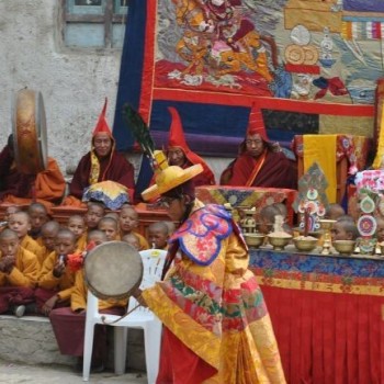
The autumn months of September to November is famous for its soothing climate and favorable temperatures. In addition to these perks, autumn is also a festive season with vibrant festivals Dashain and Tihar falling at this time of the year. 

The monsoon and the winters are generally avoided because of the risks and the challenges.  

Also Read: Best Time to Visit Nepal

What are the basic criteria for physical fitness?

Many people assume that they need to have an athletic strength to complete treks in Nepal, which is not true. A basic level of fitness with good stamina can easily lead you to success in the trails of Nepal. 

Some cardio (aerobic) exercises, including hiking, cycling, swimming, tai chi, etc. can help you gain fitness before the start of your trek. One important thing to consider is that the treks are not a race, so you need to maintain a gentle pace with sufficient breaks and acclimatization. 

If your fitness levels are on the higher side, you will enjoy the treks more and find more energy for extra activities.

Can I do trekking solo without a guide and porter?

Yes, you can trek solo in Nepal without a guide or a porter on many routes. If you come well prepared with a map or traveling a well-trodden path, you can trek pleasantly in solitude.

However, some restricted trails like Manaslu Circuit Trek do require a guide by compulsion. But there are risks of traveling without a guide mostly related to health issues and freak weather conditions. 

Also Read: Manaslu Circuit Trek Without Guide

Can you list out the packing list for trekking?

The packing list for trekking in Nepal are as follows:

Clothing

  • Trekking pants and jackets
  • Rainproof pants and jackets
  • Thermals underwear
  • Pair of Gloves
  • Short-sleeved trekking shirts
  • Long-sleeved trekking shirts
  • Woolen cap/ beanies
  • Insulating jackets
  • fleece-lined jacket
  • Lightweight Sweaters 
  • Trekking boots

First Aid

  • Band-aids
  • Anti-nausea Medicines
  • Sanitary pads/ Tampons
  • Mosquito repellent spray or ointment

Toiletries

  • Toilet Paper
  • Shampoo 
  • Soap
  • Sunscreen
  • Hand sanitizer

Accessories

  • Cameras
  • Water Bottle
  • Sleeping bag
  • Sunglasses
  • Chargers
  • Extra Batteries

Important Documents

  • Passport
  • Photo
  • Travel Permits

Can I recharge my camera batteries, phone, and other electronic batteries?

Yes, there are facilities for charging electronic gadgets like cameras, phones, and other electric batteries at an added cost. However, the charges are on the higher side, and charging time gets limited. Hence, carrying a solar-powered charger or power bank is a good option.

Can I get trekking gears and equipment on rent?

Yes, you can get any trekking gears and equipment on rent. The famous street of Thamel in Kathmandu is popularly known as “backpacker’s alley.” You can get all kinds of trekking gears and equipment, including sleeping bags, down jackets, trekking boots, for rent. 

There are many gears of knock-off brands that work surprisingly well. But you should always stay away from substandard stuff that might cause you nuisance along the trek.

Is laundry services available in teahouse?

There are a few laundry services available in places like Namche. However, in the high altitude region, these facilities get scarce. You will have to wash your clothes on your own in the sink. You can use a small amount of warm water to wash your clothes.

What is the weather like in Nepal?

There are five distinct seasons in Nepal. The summers are hot and wet, and the monsoons are wet with chances of landslides. The winters are cold with freezing temperatures in the high mountains. These seasons are not the best time to trek the region. 

The peak trekking seasons in Nepal are the autumn and the spring season. The autumn months come after the monsoon, and thus trekkers can enjoy the stable weather with perfect trekking temperatures. 

The spring is when the trails look its best. The beautiful wildflowers, including rhododendron bloom all over the trails and the scenic environment, makes the trek quite pleasant.

What types of trekking shoes or boots do I need to bring?

You will require waterproof, sturdy hiking boots for trekking the Himalayas in Nepal. There are various shops in and around Thamel in Kathmandu that lets you buy or rent specialized trekking shoes.

Trekkers do not necessarily require crampons, but if you are trekking on a snowy trail, crampons fitted trekking boots helps you get past the snow with ease. 

How will the travel company solve the problem in case of an emergency?

The guides and porters are adequately trained and skilled in handling emergencies. The travel agency is in communication with the team leader at all times through a mobile or a satellite phone. 

You will get immediate first aid and all necessary help if required. Helicopters are at standby positions in case the conditions get worse, and you need an emergency helicopter evacuation.

Are there any other outdoor activities besides trekking in Nepal?

Nepal is an adventure-lovers delight. There are many outdoor activities, including bungee jumping, paragliding, zip-lining, rafting, rock climbing, canoeing, jungle safari, and others in Nepal. You can choose the best one according to your desire and schedule.

How expensive or costly is to do trekking?

While the cost may vary according to the trails, in general, the cost of trekking ranges around $1000-$2500 on average, excluding the international flight costs. This cost includes food, accommodation, permits, guide/porter, and other fees.

Which were the trekking routes damaged by an earthquake in 2015?

The popular routes Annapurna Base Camp trek and the Everest Base Camp trek was not much affected by the earthquake in 2015. However, the pristine Langtang and Manalsu trekking region were severely affected. 

The landslide after the earthquake swept away many teahouses in the Langtang region, and more than 300 lives were lost. The quick rebuilding process led by the local community ensured that all the trekking routes get restored and repaired immediately. 

These trails are safer than ever for a trekking adventure. Trekking has since resumed in the Langtang region.

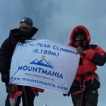
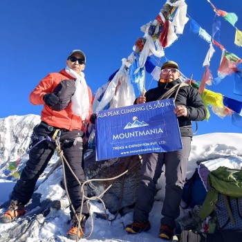
Where the most popular places to do trekking in Nepal?

There are many trekking trails in Nepal. Some of the famous trekking trails include the Everest Base Camp Trek in the Everest region. The Annapurna Circuit trek in the tranquil Annapurna region is also quite popular. 

The Upper Mustang trek, Manaslu trek, Langtang trek are also quite popular. Besides these, many off the beaten trekking routes are gaining popularity as well.

Does my guide carry a simple medical kit for general treatment?

Yes, the professional guides do carry a simple medical/ first aid kits. They are well trained and are adept at performing simple first aid if necessary. However, if the condition worsens, you will need professional medical help or even evacuation.

Do I need to carry a sleeping bag or not?

Although a warm blanket gets provided at the teahouses, carrying a sleeping bag is always a good option. The trails can get busy, and in freezing conditions, a single blanket might not be enough, and an extra blanket might not be available. Hence, a sleeping bag helps you get a good night's sleep after a long day of the trek.

What is the basic equipment do I need to bring for trekking?

The essential equipment you need to bring for trekking includes standard trekking gears and clothes, first aid kits, toiletries, and other accessories. The trekking gears and clothes include waterproof trekking jackets, sturdy boots, waterproof pants, gloves, and others. 

For first aid, you can pack band-aids, insect repellents, anti nauseant tablets, etc. You can also bring other accessories like a camera, charger, power banks, and others. 

Should I bring a tent or a mattress?

Since you will be staying in tea houses along the trek, a tent or a mattress is not necessary. The tea houses along the trail provide the facilities of bed, mattress, and blankets. 

However, if you wish to camp outside or want to trek the off the beaten remote trails, then you might need to bring your tent or mattress as the tea houses are scarce in these remote regions.

Where can I leave my personal stuff in Kathmandu when I am trekking?

You can leave your stuff in the guest houses and hotels where you will be staying in Kathmandu. These guesthouses have a unique service designed for trekkers who need to store their belongings while they go on a trek in the Himalayas. 

You can ask the caretaker to handle your backpack with care and also put up a large and visible name tag on the bags to avoid misplacement. The guesthouses readily agree to store your stuff as they can serve you further after your return from the trek.

How experienced is my trekking guide?

All our guides have been around the trekking scene for quite a while and are highly experienced. They are well equipped with proper knowledge regarding the trails and are quite pleasant and friendly. 

In case of any emergencies, the guides will prove to be a great helping hand as they are well versed in first aid. Many of them are fluent in English and other languages like French and German.

Are guides and porters insured in case of accidents while trekking?

Yes, all the guides and porters are duly insured with proper insurance in case of any accidents while trekking

Do guides and porters have proper gears?

Yes, guides and porters are well equipped with proper gear for the trek. The guides and porters are also provided with special medical/ first aid kits for emergency conditions.

Should I bring my personal medicine?

If you need to have certain medicines regularly, then you should bring your medicines on the trek. Besides that, you should also consult your doctor for any medication that you might need along the trek.

Do I need extra days in case of flight cancellation?

Adding a couple of days to your holidays is always a good idea. The flights in the Himalayan region are notorious for frequent delays or even cancellation based on the unfavorable weather conditions. A few additional days to your trekking adventure ensures that you can relax and trek without any hassle.

What is the visa cost for Nepal?

The new provision states that foreigners visiting Nepal on a 15-day multiple-entry tourist visa will have to pay $30 in fees. For a 30-day multiple-entry tourist visa, the cost is $50. The 90-day visa multi-entry tourist visas cost around $125.

Read More: The Complete Nepal Visa Guide 

Can I apply for the Nepal visa online?

Although most of the tourists apply for a visa on arrival, you can apply for the Nepal visa online in advance, as well. You can apply for the Nepal visa at most 15 days ahead of arrival in Nepal. The things required are the address of the hotel, a recent digital version of a passport-sized photo, and the filled application form online

Once you complete the submission process online, you can print out the confirmation receipt. You can display it to the Immigration officer upon your arrival at the airport and pay the proper amount to get your visa.

For further questions, please chat us online or contact us. We will get back to with answers as soon as possible.