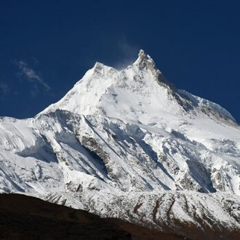
The Manaslu Circuit Trek is one of Nepal's most rewarding and underrated long-distance treks — a 12–16 day journey that loops around the world's eighth-highest mountain, Mt. Manaslu (8,163 m). Unlike the busier Everest Base Camp or Annapurna Circuit trails, Manaslu remains a restricted area, which means fewer crowds, more authentic villages, and a sense of wilderness that's becoming rare in Himalayan trekking.
Table of Contents
Plan your trip to Nepal
Customize your trip with help from a local travel specialist.
But before you lace up your boots, understanding the Manaslu Circuit Trek map and distance is essential. At approximately 177 km (110 miles), this is a serious undertaking across remote Himalayan terrain. The route climbs from subtropical river valleys to the high-altitude Larkya La Pass (5,160 m), and knowing what lies ahead on each section will help you prepare properly, pace yourself correctly, and make the most of every step.
Quick Facts at a Glance
- Total Distance: ~177 km
- Duration: 12–16 days
- Max Elevation: 5,160 m
- Start: Soti Khola / Machha Khola
- End: Dharapani (Annapurna Circuit junction)
Manaslu Circuit Trek Map Overview

The Manaslu Circuit follows a clear, logical arc through some of Nepal's most dramatic landscapes. Here is how the route unfolds from start to finish:
- Route Flow: From Soti Khola to Dharapani
- Starting Point: Most trekkers drive from Kathmandu to either Soti Khola or Machha Khola — the former being the traditional gateway, the latter a more common modern starting point due to road improvements.
- The Route: From the starting point, the trail follows the mighty Budhi Gandaki River northward through a series of gorges, subtropical forests, and increasingly dramatic Himalayan terrain. The valley narrows and opens repeatedly, revealing new landscapes every day.
- The Highlight: The entire route builds toward the Larkya La Pass (5,160 m) — a challenging but spectacular high-altitude crossing that marks the transition from the Manaslu region into the Annapurna Conservation Area.
- Ending Point: The trek concludes at Dharapani, where the Manaslu Circuit joins the famous Annapurna Circuit trail. From here, you can continue toward Besisahar or take a jeep back to Kathmandu.
Key Geographical Regions on the Map
Budhi Gandaki River Valley (Days 1–5)
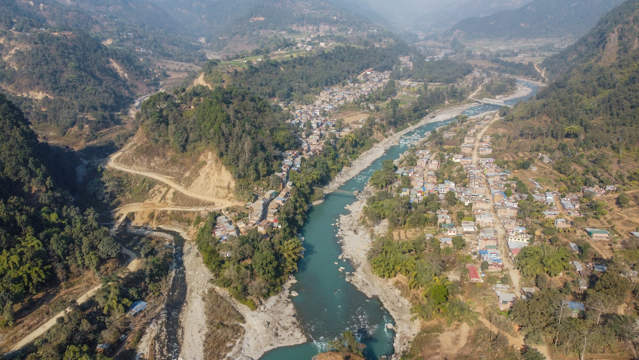
The river is your constant companion through steep gorges and lush forests. The trail frequently crosses suspension bridges and clings to cliffsides above the river.
Nubri Valley (Days 5–9)

As you enter Tibet-influenced territory, the landscape becomes more open and the villages more sparsely populated. This is Tibetan Buddhist country — expect prayer flags, mani walls, and ancient gompas.
Larkya La Region (Days 8–9)

The high-altitude section around the pass is stark and beautiful. Dharamsala (Larkya Phedi) serves as the final tea house before the crossing, and Bimthang on the other side offers dramatic views of Manaslu's south face.
Elevation Gain Pattern
Understanding the elevation profile helps you anticipate where the physical demands will be greatest:
- Days 1–4: Gradual ascent from ~890 m to ~2,600 m — manageable daily gains
- Days 5–6: Climb to Samagaon (~3,530 m) with a critical acclimatization day
- Day 7–8: Move to Samdo (3,860 m) then Dharamsala (4,460 m)
- Day 9: The big climb — summit Larkya La at 5,160 m, then descend steeply to Bimthang (3,720 m)
- Day 10: Final descent to Dharapani (~1,900 m)
Total Distance of the Manaslu Circuit Trek
- Total Distance: ~177 km (110 miles)
- Duration: 12–16 days
- Max Elevation: 5,160 m – Larkya La Pass
- Daily Walk : 5–9 hours
- Start Point: Soti Khola / Machha Khola
- End Point: Dharapani (Annapurna Circuit junction)
- Difficulty: Challenging – prior trekking experience required
- Permits Required: MCAP, ACAP and Restricted Area Permit
The total trekking distance of the Manaslu Circuit is approximately 177 km (110 miles), though this figure can vary depending on your itinerary, any side trips you take, and whether you start from Soti Khola or Machha Khola (which adds or removes roughly 7–10 km).
Why Distance Numbers Vary
Side trips: Excursions to Manaslu Base Camp from Samagaon, or to Pungyen Gompa, can add 8–15 km to your total.
Road development: Ongoing road construction in the lower Budhi Gandaki valley has shifted some trail sections in recent years.
Itinerary flexibility: A 12-day itinerary is more aggressive; a 16-day version includes more acclimatization and rest days.
Manaslu Trek Distance vs. Difficulty
On the Manaslu Circuit, a 6 km day at 4,500 m altitude can feel harder than a 22 km day at 1,500 m. Never judge a day solely by its distance. Always factor in elevation, terrain, and your body's acclimatization status.
Day-by-Day Distance Breakdown
The following table provides a complete stage-by-stage breakdown of the Manaslu Circuit Trek, including distances, estimated walking hours, difficulty ratings, and key notes for each day.
| Day 1 | Sotikhola to Machhha Khola | ~14km | 6-7 hrs | Easy-Moderate | River valley trail, jungle paths |
| Day 2 | Maccha Khola to Jagat | ~22km | 7 hrs | Moderate | Longest day; includes permit checkpoint at Jagat |
| Day 3 | Jagat to Deng | ~20km | 6-7 hrs | Moderate | Dramatic gorge scenery along Budhi Gandaki |
| Day 4 | Deng to Namrung | ~19km | 6-7 hrs | Moderate | Terrain opens up; first Himalayan views |
| Day 5 | Namrung to Samagaon | ~15km | 5-6 hrs | Moderate | Gateway to Nubri Valley; acclimatization day follows |
| Day 6 | Acclimatization Day – Samagaon | 3-4 hrs | Easy | Side trip to Manaslu Base Camp or Pungyen Gompa | |
| Day 7 | Samagaon to Samdo | ~10km | 4-5hrs | Moderate | Last permanently inhabited village before the pass |
| Day 8 | Samdo to Dharamsala (Larkya Phedi) | ~6km | 3-4 hrs | Easy-Moderate | Short day; critical rest before pass crossing |
| Day 9 | Dharamsala to Larkya La to Bimthang | ~18km | 8-9 hrs | Very hard | HARDEST DAY – cross Larkya La Pass (5,160 m) |
| Day 10 | Bimthang to Dharapani | ~21km | 6-7 hrs | Moderate | Descent into Annapurna region; trek ends at Dharapani |
Note on Day 9 (Larkya La Crossing): This is widely considered the hardest day on the entire Manaslu Circuit — not because of its distance (18 km), but because of the altitude, early 3:00 AM start time (to avoid afternoon storms), steep technical sections near the summit, and the long descent to Bimthang. Proper acclimatization in Samagaon and Samdo is essential for a safe crossing.
Key Highlights and Checkpoints on the Map
Beyond the distances and elevations, the Manaslu Circuit is defined by a series of landmark villages and natural features. Here is what to expect at each key point:
Jagat (1,340 m) — The Gateway Checkpoint

Jagat is where your restricted area permit is checked for the first time. It is a significant milestone: after Jagat, you are officially in restricted territory, and the trail becomes noticeably quieter and more remote. The village sits at the junction of the gorge and offers basic tea house accommodation.
Namrung (2,660 m) — First Himalayan Views
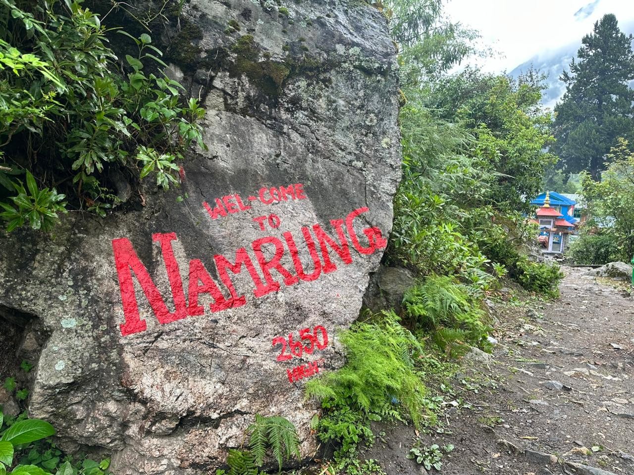
Namrung is often called the gateway to the higher Himalayas on this route. The landscape opens up dramatically here, and on clear days you get your first unobstructed views of the peaks surrounding the Manaslu massif. The village has a monastery worth visiting.
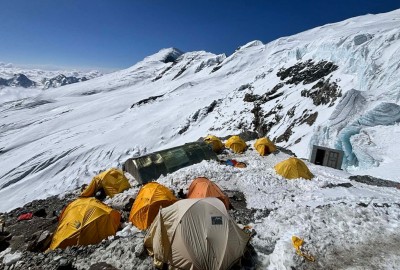
Samagaon (3,530 m) — The Acclimatization Hub
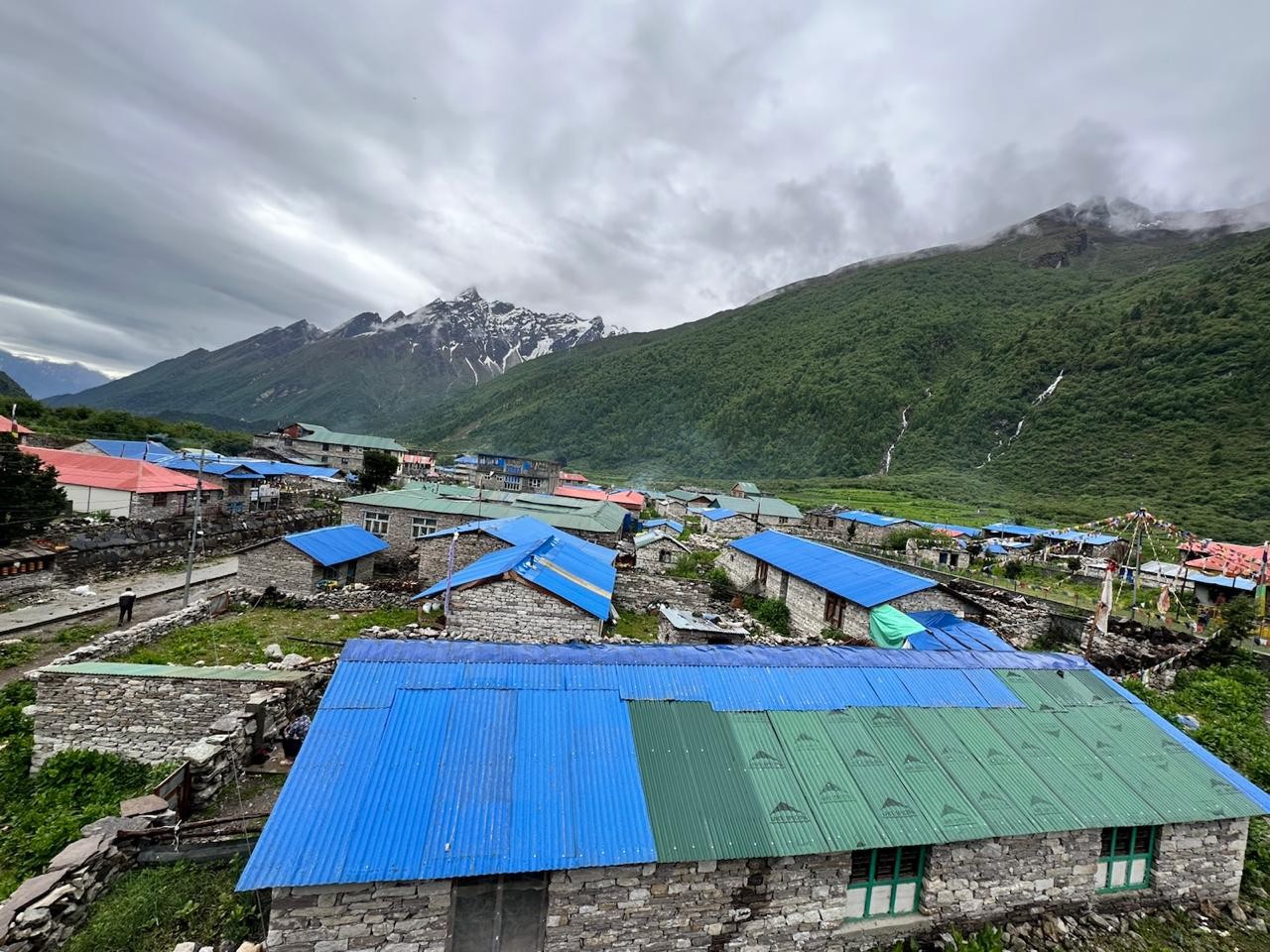
Samagaon is the most important village for acclimatization on the entire trek. Spending two nights here — with a day hike to Manaslu Base Camp (4,800 m) or Pungyen Gompa (4,050 m) — is strongly recommended and significantly reduces the risk of altitude sickness before the Larkya La crossing. The village has the best facilities on the upper circuit, including more comfortable tea houses and a health post.
Samdo (3,860 m) — Last True Village
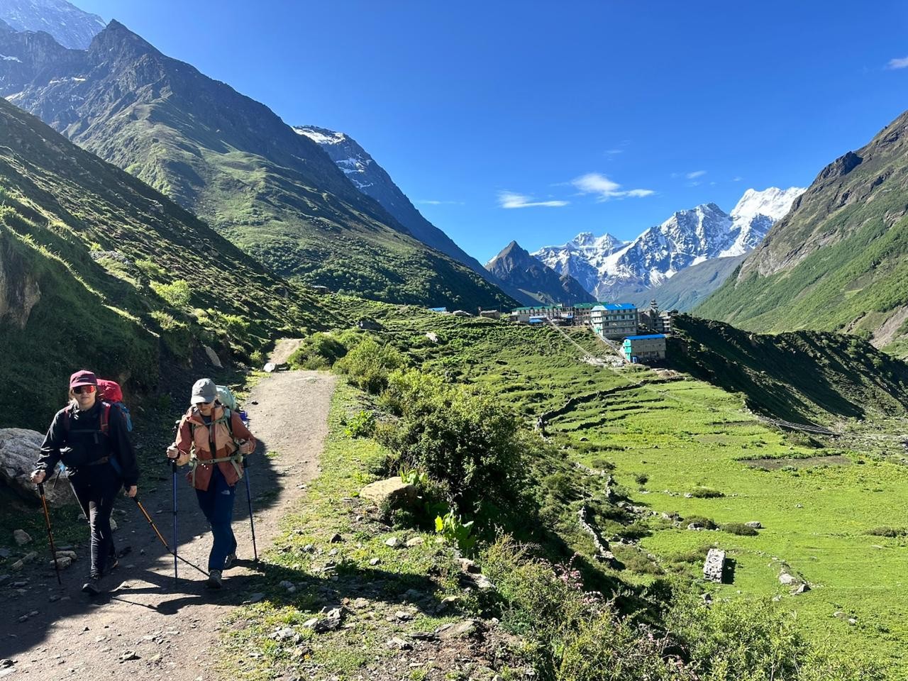
Samdo is a small Tibetan-origin settlement and the last permanently inhabited village before the Larkya La Pass. The trail to Lhajung (on the Tibet border) can be seen from the village. Your night here is critical — a good rest in Samdo sets you up for the challenging section ahead.
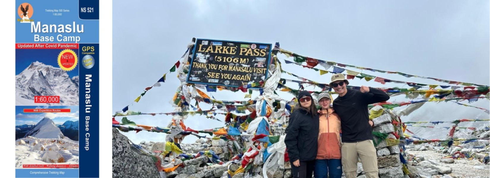
Larkya La Pass (5,160 m) — The Crown of the Trek
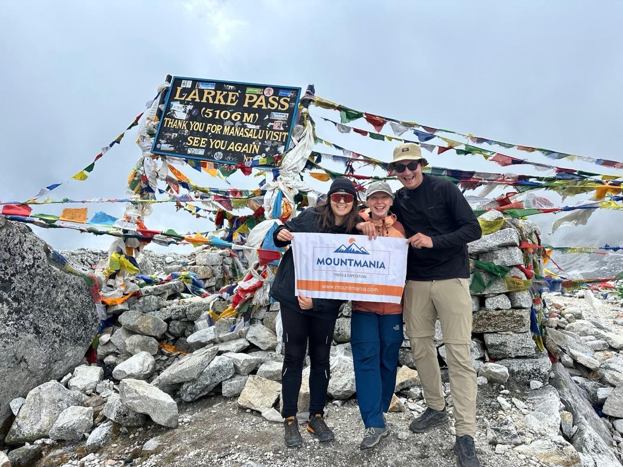
The Larkya La is the emotional and physical centrepiece of the entire Manaslu Circuit. The pass itself offers 360-degree views of Himalayan giants including Manaslu, Himlung, Cheo Himal, and Annapurna II on clear days. The crossing is typically done in the pre-dawn darkness to ensure safe descent before afternoon cloud buildup. Trekkers often describe crossing Larkya La as one of the most memorable experiences of their lives.
One of the most common mistakes first-time high-altitude trekkers make is equating distance with difficulty. On the Manaslu Circuit, this misunderstanding can have serious consequences.
Why Altitude Matters More Than Distance
- At 4,000 m, your body receives roughly 40% less oxygen per breath than at sea level
- Trails that would take 3 hours at low elevation can take 5–6 hours at altitude
- Even short uphill sections trigger rapid heart rate and breathlessness
- Decision-making, balance, and energy levels are all impaired by altitude
How Manaslu Compares to Other Major Treks
| Feature | Manaslu Circuit | Everest Base Camp | Annapurna Circuit |
| Total Distance | ~177 km | ~130 km | ~160–230 km |
| Max Elevation | 5,160 m | 5,364 m | 5,416 m |
| Duration | 12–16 days | 12–14 days | 12–21 days |
| Crowd Level | Low–Moderate | Very High | High |
| Permit Type | Restricted | Standard | Standard |
| Trail Condition | Remote/Rough | Well-developed | Well-developed |
| Difficulty | Challenging | Moderate–Hard | Moderate–Hard |
Also Read: Manaslu Circuit vs. Everest Base Camp: Which Trek is Harder?
Who is This Trek Suitable For?
- Good fit: Trekkers with previous experience at altitude (3,000 m+), moderate-to-good fitness, at least 12 full days, and a willingness to work with a licensed guide (required for the restricted area).
- Not recommended for: First-time trekkers, those with a history of altitude sickness, or anyone who cannot commit to the mandatory acclimatization schedule.
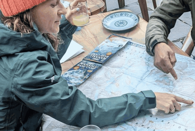
Tips to Read the Manaslu Trek Map Properly

A good map is only useful if you know how to interpret it in the context of high-altitude trekking. Here are essential tips for smart map reading on this route:
- Look at contour lines, not just routes: Contour intervals on topo maps show you where the hard climbs are. Days 8–9 feature extremely tight contours, indicating steep elevation gain.
- Plan acclimatization days into your route: Mark Samagaon as a two-night stop on your map from the beginning. Do not treat it as optional.
- Build in buffer days: Weather, particularly early season snowfall on Larkya La, can force a one-day delay. Most itineraries should have at least one extra day built in.
- Download offline maps before you go: Cell service is extremely limited on the upper circuit. Apps like Maps.me and AllTrails have downloadable Manaslu Circuit maps. Garmin GPS devices are also popular with experienced trekkers.
- Note permit checkpoints: Your map should show you where TIMS and restricted area permit checks occur — Jagat, Samagaon, and Dharamsala. Missing these can cause complications.
- Cross-reference elevation profiles: Many trekking apps show elevation alongside the route map. Use these to mentally prepare for each day's challenge.
Common Mistakes Trekkers Make on the Manaslu Circuit
Most trip failures on the Manaslu Circuit come down to poor planning, not poor fitness.
- Underestimating distance at altitude: "Only 10 km today" sounds easy until you are at 4,000 m with a full pack on a rocky, uneven trail. Always check elevation gain alongside distance.
- Ignoring acclimatization guidelines: Skipping the rest day in Samagaon is the most frequent cause of emergency evacuations on this route. Follow the rule: ascend slowly, rest regularly.
- Overpacking: The Manaslu trail has sections with no porter access for heavy loads. Aim for a 10–12 kg pack weight maximum. A licensed porter can carry up to 25 kg if needed.
- Rushing the itinerary: Some operators offer 10-day Manaslu Circuit packages. These compress acclimatization and significantly increase altitude sickness risk. Always allow 12–14 days minimum.
- Inadequate gear for Larkya La: The pass is cold, windy, and often icy — even in October. Crampons or microspikes, good gloves, and layered insulation are non-negotiable on crossing day.
- Not hiring a licensed guide: The Manaslu Circuit is a restricted area. A licensed guide is legally required. Beyond compliance, a knowledgeable local guide can make a decisive difference in safety and experience.
Recommended 12-Day Manaslu Circuit Trek Itinerary
The following itinerary represents an optimized 12-day schedule that balances daily distance, acclimatization, and the Larkya La crossing safely:
Day 1: Kathmandu → Drive to Machha Khola — Road journey (~8–9 hrs drive); arrive and rest
Day 2: Machha Khola → Jagat — ~22 km | 7 hrs | Permit check at Jagat
Day 3: Jagat → Deng — ~20 km | 6–7 hrs | Gorge scenery along Budhi Gandaki
Day 4: Deng → Namrung — ~19 km | 6–7 hrs | First Himalayan peak views
Day 5: Namrung → Samagaon — ~15 km | 5–6 hrs | Enter Nubri Valley
Day 6: Acclimatization – Samagaon — Side hike to Manaslu Base Camp or Pungyen Gompa
Day 7: Samagaon → Samdo — ~10 km | 4–5 hrs | Last village before pass
Day 8: Samdo → Dharamsala (Larkya Phedi) — ~6 km | 3–4 hrs | Critical rest day before crossing
Day 9: Dharamsala → Larkya La (5,160 m) → Bimthang — ~18 km | 8–9 hrs | Start 3:00 AM
Day 10: Bimthang → Dharapani — ~21 km | 6–7 hrs | Trek ends; join Annapurna Circuit
Day 11: Dharapani → Drive to Kathmandu — Road journey (~8 hrs)
Day 12: Buffer / Rest Day in Kathmandu — Debrief, celebration, or flexibility for delays
Flexible versions:
For a more relaxed 14–16 day experience, add an extra acclimatization night in Namrung, an additional rest day in Samdo, and buffer time around the Larkya La crossing. For trekkers joining the Annapurna Circuit from Dharapani, the combined route can extend to 21+ days.
Conclusion
The Manaslu Circuit Trek is not just about covering distance — it is about navigating one of Nepal's most remote and rewarding Himalayan routes. With a total distance of around 177 km and a maximum elevation of 5,160 m at Larkya La Pass, this trek demands preparation, patience, and the right support.
Understanding the map and distance breakdown before you arrive is one of the most effective things you can do to ensure your safety and enjoyment on the trail. Know your rest days, respect the altitude, and build your itinerary around acclimatization — not just kilometres.
If you are looking for a quieter, more authentic trekking experience compared to Everest or Annapurna, the Manaslu Circuit is an exceptional choice. The villages are traditional, the landscapes are dramatic, and the sense of accomplishment at Larkya La is unmatched.
Plan Your Manaslu Adventure with Mount Mania Specialists in Manaslu Circuit Trekking
At Mount Mania, we specialize in organizing well-structured Manaslu Circuit treks with:
- Experienced, licensed local guides who know the route intimately
- Optimized itineraries designed for safety and proper acclimatization
- Flexible trip customization for solo trekkers and groups
- Full permit arrangement and logistics support
Contact Us today and start planning your Manaslu Circuit Trek with confidence.

Rupak Parajuli
Send an Enquiry
Plan your trip to Nepal
Customize your trip with help from a local travel specialist.