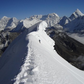
Here are the four base camps in the Everest region you should not miss: what the route looks like, what the landscape feels like, and which mountains you will see.
1. Everest Base Camp (5,364 m)

The original and still the most famous. Everest Base Camp is where expeditions to the world's highest mountain live for weeks each spring, and reaching it is one of the great trekking goals on the planet.
The route. From Tengboche the trail climbs to Dingboche, the main acclimatization stop, then to Lobuche at the foot of the Khumbu Glacier. From Lobuche it is roughly 5 km (about four hours) to Gorak Shep, then another 3.5 km (about two hours) to base camp. Gorak Shep, at 5,164 m, is the highest place you will sleep. The full round trip from Lukla is around 130 km and usually takes 12 to 14 days.
The landscape. Above Dingboche the green valleys fade. By Lobuche you are walking beside the Khumbu Glacier, and the final stretch to Gorak Shep and base camp is almost entirely glacier moraine: grey rock, ice and silence. Base camp itself is a spread of tents on the rubble at the foot of the Khumbu Icefall, a frozen river of ice towers that climbers must pass on their way up Everest. In spring, the camp is a small town of expedition tents and prayer flags; in autumn it is quiet and empty.
The mountains you see. Here is the surprise: you cannot see Everest's summit from base camp. It hides behind Nuptse and Lhotse. Instead, the peaks of Lingtren, Khumbutse and Everest's West Shoulder rise straight above the camp and the icefall, and the huge ice walls of Nuptse (7,861 m) tower over the glacier. On the walk in you also see Pumori (7,161 m), the "Daughter of Everest", and Changtse (7,543 m) on the Tibetan side.
Don't skip Kala Patthar. For the classic Everest view, climb Kala Patthar (5,545 m) from Gorak Shep, ideally before sunrise. From this black rocky hill you see the full summit pyramid of Everest, along with Nuptse, Pumori and Changtse. It is the highest point of the trek and, for most people, the best moment of it.
2. Ama Dablam Base Camp (about 4,600 m)

If Everest Base Camp is the famous one, Ama Dablam Base Camp is the beautiful one. Ama Dablam (6,812 m) is often called the Matterhorn of the Himalayas, and its name means "mother's necklace": the ridges on either side look like a mother's arms, and the hanging glacier on its face like the dablam, a traditional Sherpa pendant.
The route. Follow the Everest trail past Tengboche to Pangboche (3,930 m), one of the oldest Sherpa villages in the Khumbu. From there, a side trail drops to the Imja Khola river and then climbs steadily east to base camp. Most trekkers do it as a day hike from Pangboche: about 8 km and 5 to 6 hours return. Some itineraries approach via Mingbo, or spend a night camping at base camp. A full trip from Lukla takes around 10 to 13 days, making it a great choice if you have less time than EBC needs.
The landscape. This is the green base camp. Instead of glacier rubble, you arrive on a wide, flat grassy meadow at the foot of the mountain, with yak pastures and old stone huts nearby. Climbers often compare it to an Alpine meadow. A small teahouse now runs a short walk from camp. For photographers, climb the low hill behind base camp: it looks down over the whole meadow with Ama Dablam rising above it.
The mountains you see. Ama Dablam's southwest face fills the sky directly above you, close enough to pick out the climbing route. Turn around and you see Everest, Lhotse and Nuptse in the distance, plus Thamserku, Kangtega, Taboche and Cholatse around the valley.
Why go. It is quieter than EBC, lower in altitude, and shorter, yet the views are some of the best in the region. It is an ideal first Himalayan trek, or a peaceful side trip on the way back from Everest Base Camp.
3. Lobuche East Base Camp (about 4,950 m)
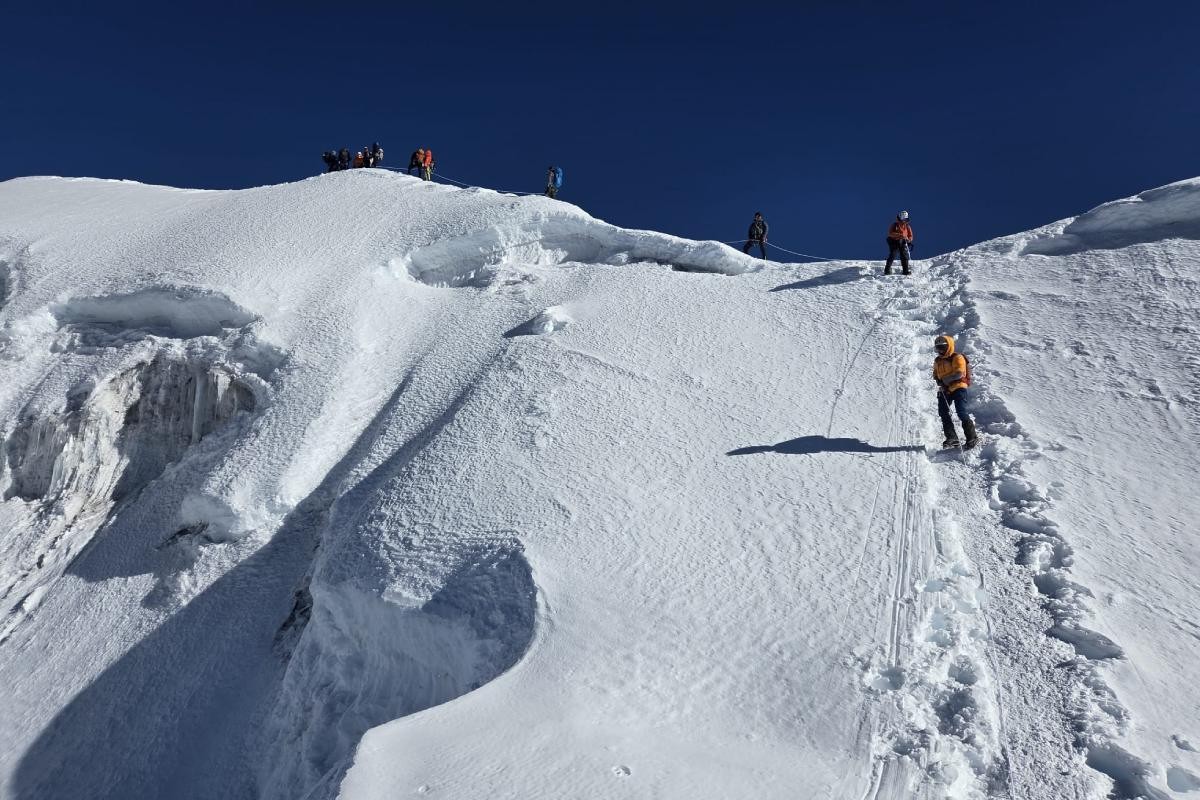
Anyone who has trekked to Everest Base Camp has walked right past Lobuche Peak. Its two summits, Lobuche East (6,119 m) and Lobuche West (6,145 m), are sharp three-sided pyramids that dominate the view as you approach Lobuche village. Lobuche East is one of Nepal's most popular climbing peaks, and its base camp is a fine destination in its own right.
The route. Follow the EBC trail to Lobuche village (about 4,940 m). Most climbing itineraries continue to Everest Base Camp and Kala Patthar first for acclimatization, then return to Lobuche. From the village, the trail leaves the main path and crosses rocky ground and glacial moraine beneath the peak to reach base camp in a few hours. There are actually two base camp sites: an eastern one close to Lobuche village and a western one reached on the trail toward Dzongla and the Cho La pass.
The landscape. The eastern camp sits in a rocky hollow beside a small glacial lake, right below the glaciated southwest face of the mountain. The Dzongla-side camp is more open and grassy, on the southern slopes at around 4,800 m. Either way, it feels wild and far from the crowds, even though the busy EBC trail is only a short walk away.
The mountains you see. From base camp the views of Ama Dablam, Pumori and Everest are superb, and Lobuche's own ice face rises directly above. Climbers who reach the summit get a full 360-degree panorama that adds Lhotse, Nuptse and, on a clear day, Makalu, the world's fifth-highest mountain.
Why go. It is the perfect step from trekking into mountaineering. Trekkers can visit base camp as an add-on to EBC; climbers use it as a launch point for a first 6,000 m summit.
Planning to climb? See our Lobuche Peak Climbing Base Camp Service for camp setup, meals and climbing support at Lobuche East.
4. Island Peak (Imja Tse) Base Camp (about 5,087 m)

Island Peak got its English name from the 1953 Everest expedition: seen from Dingboche, it looks like an island in a sea of ice. Its Sherpa name is Imja Tse, and at 6,189 m it is the most climbed trekking peak in Nepal. Its base camp sits in one of the most dramatic corners of the Khumbu.
The route. Leave the EBC trail at Dingboche and walk east up the Imja valley to Chhukung (4,730 m), the last settlement. From Chhukung it is about three hours on a gradual trail along the moraine of the Lhotse Glacier. The path then skirts the shore of Imja Tsho lake and crosses open ground to base camp. Trekkers who are not climbing can do it as a 6 to 7 hour return hike from Chhukung, a popular acclimatization day on the Three Passes trek.
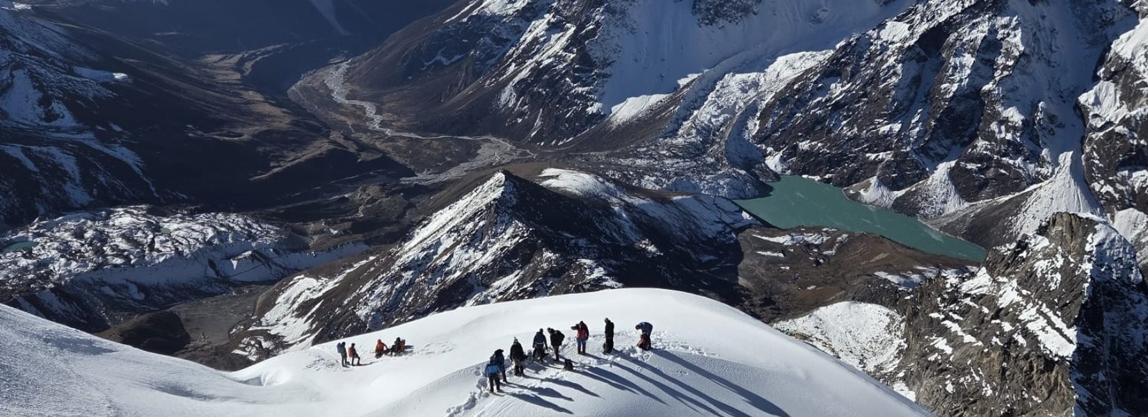
The landscape. This is the most glacial of the four camps. The Chhukung valley is boxed in by the south faces of Lhotse and Nuptse, the slopes of Baruntse to the east, and the north side of Ama Dablam to the south. The Imja Glacier fills the top of the valley and feeds Imja Tsho, a milky blue glacial lake right beside camp. It is dry, dusty and high, with very little vegetation: pure mountain terrain.
The mountains you see. The star is the Lhotse South Face, one of the largest mountain walls in the world, rising more than 3,000 m above the valley. You also see the less familiar north side of Ama Dablam, Island Peak's own glaciated slopes, and the Baruntse group to the east. From the summit, climbers see Everest, Lhotse and Makalu.
Why go. It feels the most remote of the four, and the scale of the Lhotse wall is unforgettable. It also pairs well with the Kongma La pass, which links Chhukung to Lobuche.
Heading for the summit? Our Island Peak Climbing Base Camp Service covers base camp logistics and climbing support on Imja Tse.
The four base camps at a glance
| Base camp | Altitude | Leaves the EBC trail at | Landscape | Signature view | Best for |
|---|
| Everest Base Camp | 5,364 m | End of the main trail | Glacier, moraine, Khumbu Icefall | Nuptse and the icefall; Everest from Kala Patthar | The bucket-list classic |
| Ama Dablam Base Camp | ~4,600 m | Pangboche | Grassy alpine meadow | Ama Dablam's southwest face up close | Shorter trips, first-timers, photographers |
| Lobuche East Base Camp | ~4,950 m | Lobuche village | Rocky hollow with a glacial lake | Pumori, Everest, Ama Dablam | Trekkers ready to try a 6,000 m peak |
| Island Peak Base Camp | ~5,087 m | Dingboche, via Chhukung | Glacier valley and Imja Tsho lake | Lhotse South Face | Remote feel, Three Passes trekkers, climbers |
Altitudes for the smaller camps vary between sources and tent sites, so treat them as approximate.
Altitudes for the smaller camps vary between sources and tent sites, so treat them as approximate.
Planning tips
- Best seasons: spring (March to May) and autumn (late September to November) bring the clearest skies. Spring is expedition season at EBC; autumn has the sharpest mountain views.
- Permits: all four camps lie inside Sagarmatha National Park, so you need the national park entry permit and the Khumbu Pasang Lhamu rural municipality permit. Climbing Lobuche East or Island Peak also needs a peak climbing permit, arranged through a registered agency.
- Acclimatize properly: every camp is above 4,500 m. Build in rest days at Namche and Dingboche, climb high and sleep low, and descend at the first sign of serious altitude sickness.
- Combine them: because the routes split only after Tengboche, you can link camps in one trip. A popular plan is EBC and Kala Patthar, then the Kongma La pass to Chhukung and Island Peak Base Camp, with Ama Dablam Base Camp as a side trip from Pangboche on the way down.
- Go with a local team: a licensed guide and porter make the trek safer, support the Sherpa economy, and take care of teahouse bookings, permits and logistics.
Whichever base camp you choose, you will stand at the foot of a legendary mountain, in a place few people ever see. Ready to plan yours? Mount Mania Treks & Expedition runs guided trips to all four base camps, with itineraries built around your time and fitness.