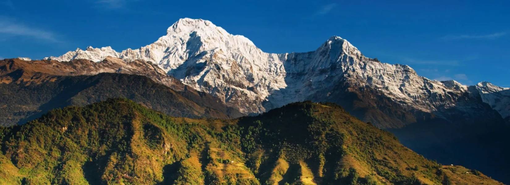
Annapurna region is the most famous and diverse trekking area in Nepal. It stretches into the historic Mustang region and is a dream for independent trekkers. Some of Nepal's most iconic mountains are combined here like the Annapurna itself along with the fishtailed Machhapuchhare. The trekking infrastructure is superb here and most trailheads are an hour or two away from Pokhara so it has easy access. Cultural highlights are added by the Thakali, Gurung and Manangi villages
Table of Contents
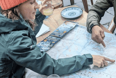
Plan your trip to Nepal
Customize your trip with help from a local travel specialist.
Mountains & Rivers in the Annapurna Region
The primary attraction of this part of Nepal is the range of mountains Annapurna I which was the first of the 8000m peaks to be climbed. Located to the east of Annapurna I, Dhaulagiri which is another 8000m giant situated in this region.
The valley of the Kali-Gandaki River is situated between these two mountains. It is the deepest gorge in the world. The tribe of this region is the Thakali tribe, who can be encountered by trekkers. Thakali people are known for being good cooks and good in business ventures and their cooking is praised by the locals as well as foreigners.
Annapurna Trek is one of the most pleasant treks among all destinations in Nepal as you can get a diverse range of experiences, including views of the luscious and undisturbed forests, fertile farmland, snow-capped mountains and the different ethnic tribes living here. The whole Annapurna chain of mountains along with Manang and Mustang lies in the rain shadow area as the chain of mountains lie inland. Therefore, the ideal time for trekking would be during the monsoon as there is no rainfall and the temperatures are moderate in these areas.
Compared to the southern slopes of mountains, these parts are considerably drier which leads to an arid landscape. Compared to the lower region where there are green pastures and fertile farmland, this is desert-like.
Places to Visit in Annapurna Region
Upper Mustang
A trek to the upper mustang will let you experience the way of life of the true mountain people who had very little contact with the rest of Nepal for hundreds of years and who have preserved their rich cultural heritage. The Government of Nepal until recent times did officially recognize their king.
Getting to trek to Upper Mustang is a privilege. As geographically it is a part of the Tibet plateau, it is similar to trekking in Tibet. Until 1950, the district of Mustang was a separate kingdom within the boundaries of Nepal. In the ancient capital of Lo Manthang, the last king of Mustang still has his home.
The access to Upper Mustang has only opened 15 years ago to non-Nepali trekkers and the access is highly restricted even today. Trekkers need a special trekking permit and need to travel further north of Kagbeni to enter Upper Mustang. They must also be accompanied by a government-appointed official. Upper Mustang is suitable for trekking even during the monsoon as it falls in the Himalayan rain shadow. During the monsoon, the upper Kali Gandaki is quite dry and there is occasional rainfall.
While the highest point that can be reached on the Mustang trek is only 3,800 meters, it is not that difficult but the condition might be grueling. Mustang is cold during the winter and is dusty and windy throughout the year. It is recommended to avoid the winter trek due to unfavorable weather. The number of accommodations is few above Kagbeni so you must be self-sufficient especially for fuel. Porters are available in Jomsom but it is preferred to use mules to carry loads up to Mustang. Pack animals are more easily available and are more economical and environmentally friendly than porters.
The old capital, Lo Manthang can be reached in four days and it is recommended to spend an extra day here so you can take in the sights and sounds of the unique settlement. If you do not desire to walk then you can hire ponies. For the return trip, you can either go back the way you came or take an alternative route through the eastern banks of the Kali Gandaki.
Jomsom and Muktinath
You can get an insight into the way of life of various ethnic groups of Nepal along this trekking route. You can also see the diverse culture and landscape it has to offer. The deepest gorge created by the Kali Gandaki River is the primary attraction of this place. It originates in the Tibetan plateau and flows into the Ganges in India.
A popular pilgrimage site for Buddhists along with Hindus, called Muktinath is not too far from Jomsom. Muktinath is a sacred place of salvation to the Hindus who believe that bathing in the water here guarantees salvation after death. God Brahma is said to have lit the eternal flames that burn at Muktinath by Hindus. According to Buddhists, the great sage Guru Rinpoche came to meditate in Muktinath. Guru Rinpoche (Padmasambhava) is the one who brought Buddhism to Tibet. Along the upper reaches of the Kali Gandaki, you can find Shaligram (fossilized ammonites)
The lower region of Kali Gandaki is inhabited by Gurungs and Magars, around Jomsom are the Thakalis and around Muktinath and up in Mustang, you can find the Lopa who are people with strong Tibetan roots. This trek is suitable to observe the diversity of the ethnic groups and their different customs and attire. While Hinduism prevails in the lower region, further up Tibetan Buddhism is dominant. One of Nepal's unique festivals named Yartung (annual horse race) is celebrated in early September in Muktinath. It has some serious Tibetan style horse racing as well as merry-making.
A part of the Annapurna foothills treks and Annapurna Circuit is formed by the routes along Jomsom. Naya Pul on the Pokhara to Baglung road is the usual starting point and from there through Ghorepani and Tatopani into the gorge of Kali Gandaki. There is a drastic change in scenery between Tatopani and Lete Khola. Villages take on a different appearance and pine forests are along the trail. The design of the houses and the layout of villages are quite unique to this area. The houses are built in a way that protects its inhabitants every day from the strong winds that start from the late morning.
The difference in atmospheric pressure between the Tibetan plateau and the lower reaches of the valley causes the wind. Marpha gives the epitome of the unique architecture of this region and it is a two-hour walk down from Jomsom. The flat-roofed houses with a central courtyard and stone flagged streets with drainage system makes it an excellent place to rest in. You can sample the products grown in the orchards during your free time.
Jomsom is mostly known for its airport which offers a quick entry and exit to the valley with regular flights from Pokhara. After 11 a.m., the strong winds prevent the flights from taking off. Jomsom is also a place that can be used as a base to explore the upper part of the Kali Gandaki region. You can find plenty of accommodation and a new high-class resort complex has opened there. Kagbeni which is a two-hour trek up the valley is an alternative to Jomsom as a base for the trek. Kagbeni is not as hectic as Jomsom and it is quite peaceful. Kagbeni is the furthest you can trek without a permit and an accompanying Environmental Officer.
Annapurna Circuit
Annapurna circuit is the classic trek in the Annapurna region. The trek encompasses the popular Annapurna mass, passes through trans-Himalayan Manang, sub-tropical plains in the Himalayan foothills and the rain shadow region of Mustang. Thorang La with a height of 5,416 m is the highest elevation you reach before the trail pursues the Kali Gandaki river which flows between two giant peaks through the deepest gorge on earth.
Starting with a drive from Kathmandu to Besisahar and ending in Pokhara, the trek often lasts 15-22 days. All trekkers must have an entry permit for ACAP (Annapurna Conservation Area Project) which can be found in Kathmandu. The bus is usually what the trekkers ride from Kathmandu to get to Besisahar which takes about 6-8 hours. The small market town of Khudi is up to where the trek follows the road.
The first few days takes you to the Marsyangdi river and walking through the luscious green valleys inhabited by mostly the Gurung ethnic group. Then it goes through Pisang (3,200m) and Chame (2,685m) before taking you to Manang. You can get a gorgeous panoramic view of the Annapurna range of mountains while climbing up the Barga Hill before reaching Manang (3,535m).
Along the way, you come across an abundance of tall waterfalls that cascade into the main river while the sky is overtaken by the Annapurna and Manaslu ranges. The small tea houses at Thorang Phedi can be reached after you follow the trail that goes uphill through high alpine pastures from Manang. From this point, you have to be careful about high altitude sickness. It is recommended to stay a day in Manang to view a glacial lake given life by the icefall from Gangapurna.
Then the treks continue through Thorang La after which to get to Muktinath you have to travel across a desert. On the southern horizon, the summit of Dhaulagiri (8,167m) becomes visible during the descent. Muktinath is quite famous and gets lots of visitors. It is a pilgrimage site for Buddhists and Hindus. To the west of Muktinath, you can get a view of Dhaulagiri while to the north you can see the hills of Upper Mustang. As there are no accommodations in Muktinath, you have to travel to Ranipauwa (3710m) to get accommodations.
You have to walk down to Kagbeni from Ranipauwa. Then you go down through Marpha (2680m) which is known for its unique alcoholic drinks made from apples, peaches or apricots. In Jharkot and Ekle Bhatti village, you can find the Tibetan stock people. By walking along the river, you'll get to Jomsom (2713m). Then you get to Ghorepani through Tatopani(gets its name from the hot springs nearby). If you stop at Ghorepani, you can see the spectacular sunrise view of Dhaulagiri and from Poon Hill, you can see Annapurna I and Annapurna South at dawn.
The trek is then continued downhill through Birethanti and Tikhedhunga by the Burundi river. Naya Pul is a short distance away and you can get a ride to Pokhara from there. You can either fly or catch a bus to Kathmandu from Pokhara.
Need Help Planning a Trip to Annapurna Region?
Contact us, if you need any help planning a trip to the Annapurna Region or any part of Nepal.

Rupak Parajuli
Send an Enquiry
Plan your trip to Nepal
Customize your trip with help from a local travel specialist.