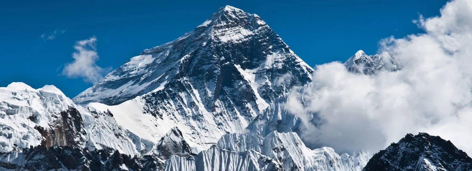
Mount Everest lies in Southern Asia on the border between Nepal and Tibet. It is called by a variety of names; in Sanskrit and Nepali it is called Sagarmatha, and in Tibet Chomolungma, the Chinese prefer Zhumulangma Feng or Chu-mu-lang-ma Feng. Mount Everest takes the crown of the tallest mountain in the world with a height of 8848 meters (29035 feet).
Table of Contents
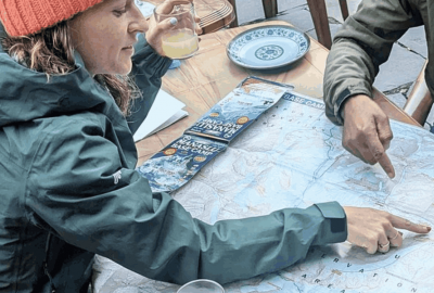
Plan your trip to Nepal
Customize your trip with help from a local travel specialist.
Where is Mount Everest Located?
Mount Everest has been admired by the locals like other high peaks in the region and even the names given by the people honor it. Sagarmatha means "Peak of Heaven" while Chomolungma means "Goddess Mother of the World". Mount Everest was only recognized as the highest peak in the world when the governmental survey of India entrenched it in 1852. The mountain was renamed for Sir George Everest (British surveyor-general of India from 1830 to 1843) in 1865. It was previously named Peak XV.
How Mount Everest was Formed?
The movement of the Indian-Australian landmasses from the Northward side to the Southside upshot the Himalayan range by the tectonic action. Between 40 and 50 million years ago, the action was subdued under the Eurasian Plate following the collision of the two plates. About 25 to 30 million years ago, the Himalayas started rising and the great Himalayas began taking place during the Pleistocene Epoch. A large mountain mass is formed by Everest and its surrounding peaks which form the main point of tectonic action in the Great Himalayas. The global positioning instruments have been giving the information that the mountain continues to move a few inches northeast and rises a fraction of an inch every year since the late 1990s.
Multiple layers of rock folded into themselves in order to form Everest. Metamorphic gneisses and schists topped by igneous granites are in the lower elevations. Sedimentary rocks of marine origin are on a higher level. Just below the summit pyramid is a limestone formation visible called the Yellow Band.
In the Everest summit, the Northeast, Southeast and West ridges are barren. On the South Summit is the Southeast Ridge which has a minor bump with an elevation of 8748 meters (28,700 feet). The northeastern side is where the mountain can be seen from and it rises about 3,600 meters (12,000 feet) above the Plateau of Tibet. With a height of 7,560 meters (24,803 feet), the peak of Changtse lies in the North. To the West and South, Nuptse (7,861 meters), Lhotse (8516 meters) and Khumbutse (6,665 meters) surround the Everest.
A three-sided pyramid form is taken up by the Everest. Ridge is the line that joins the two faces and faces are the three generally flat planes constituting the sides. The North face is bounded by the North ridge and West ridge and it rises above Tibet. The North Col at the start of North Ridge and the Great Hornbein steep gullies are the main features of this side of the mountain. The West and the Southeast ridge bounds the Southwest Face which rises above Nepal. The Khumbu Icefall and the South Col is its main feature. The Khumbu icefall is a collection of large blocks of ice that has been a challenge for climbers. The Kangshung Face (East face) is bounded by the Southeast Ridge and Northeast Ridge and it rises above Tibet.
Rock hard snow exceeded by a layer of soft snow that usually varies annually by 1.5-6 meters (5-20 feet) is found on Everest's summit. After the monsoon in September, the snow level is highest and the strong northwesterly winds deplete the snow in May. The oxygen level is one-third of what is at sea level as the upper slopes and summit are so high in the Earth's atmosphere. The development of any life is depleted by the lack of oxygen and cold temperature.
How is the Weather in Everest?
The slope along with the base of Everest is covered by glaciers. The Kangshung glacier flanks the mountain to the East while the East, West and Central Rongpu glaciers to the North and Northwest. To the South and West is the Khumbu glacier which survives because of the Western Cwm glacier bed. Western Cwm is in between Lhotse-Nuptse Ridge and Everest to the south and is an ice enclosed valley. The main reason behind the heavy and continuous Everest and other high Himalayan peak erosion is the glacial activity.
To the North, East and Southwest is the mountain drainage pattern. Lobuche river of Nepal is where the Khumbu Glacier melts and it flows southward as the Imja River to Dudh Koshi river. The Pumori and Rongbuk glaciers are where the Ring river originates from in Tibet. The Kangshung glacier gives birth to the Kama river. Both of the rivers flow in the Arun River which cuts through the Himalayas into Nepal. The northern, southern and eastern access to the summit is formed by Rong, Dudh Koshi, and Kama river valleys.
The chances of survival of life have always been nonexistent in Everest. The warmest temperature is -19°C in July on the summit and on the coldest month, the average is -36°C and it can go as low as -60°C. The temperature fluctuates suddenly as well as the storms. The lower level of the jet stream is reached by the peak of Everest. During the summer monsoon (late May to mid-September), the snow is formed by precipitation. To the climbers, the risk of frostbite is extremely high.
How to Climb Mount Everest?
Edmund Hillary and his Tibetan guide Tenzing Norgay were the first ever recorded people to climb Everest. They hold the record together by climbing it in 1953. Indigenous groups have lived in the valleys for a long time. Among them, the Sherpas are the most popular ones. The word Sherpa is associated with mountain guides although it actually means an ethnic group. The Sherpas have experience in mountain climbing and they provide it to other climbers. Without Sherpa's knowledge and logistical help, the climb to Everest would be impossible. Their way of life is not only limited to being mountain guides. Traditionally they do trade, herding, and farming and they are accustomed to the low oxygen level as they live in a high altitude all year round.
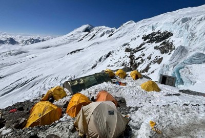
For mountain climbers, climbing Mount Everest has become a famous sport. However, it is dangerous as a lot of experience in mountaineering, good health, equipment, and a trained Nepalese guide is needed to do it. Even then the risks are high. Deadly hazards like avalanches are created by snow and ice on the mountain. Due to the bad weather, there is only a limited climbing season. The primary danger is altitude. As most climbers are not used to low oxygen levels and high altitude, they rely on bottled oxygen that they bring with them. Hence, why the area above 8000m is called the "death zone" in Everest. There also might be a problem of altitude sickness or brain swelling in climbers who spend long periods of time here.
There have been more "traffic jams" as the popularity of the climb to Mount Everest has increased. It has created a controversy as climbers spend too much time waiting in the death zone to go to the summit. As the number of climbers has increased, the pollution has also increased as climbers discard unwanted objects along the way. The traditional way of life of the Sherpas has also been disrupted by the climbers and the Sherpa people have been exploited. For little pay, the number of deaths of Sherpa people is extremely high. Moreover, the number of climbers who've died along the way is high and it is impossible to retrieve the corpses. The climbers must travel past the corpses frequently to get to the top of the mountain.
Contact us, if you need any help in climbing Mount Everest or Trekking to Everest Base Camp and other popular Trekking in Everest Region.

Rupak Parajuli
Send an Enquiry
Plan your trip to Nepal
Customize your trip with help from a local travel specialist.