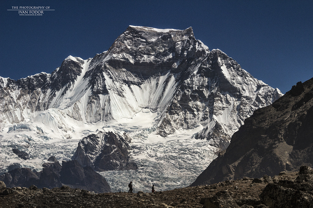
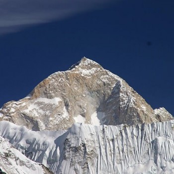
Mount Everest
- Elevation: 8,848 m (29,029 ft)
- Geographical location: Mahalangur Himalayan Mountain Range, Solu-Khumbu district
- First ascent on May 29, 1953
- First ascent by Sir Edmund Hillary and Tenzing Norgay Sherpa
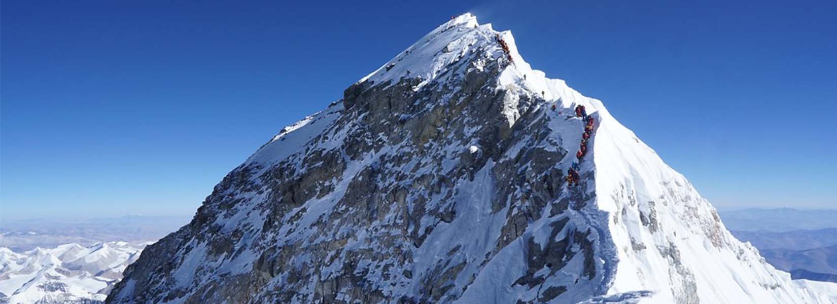
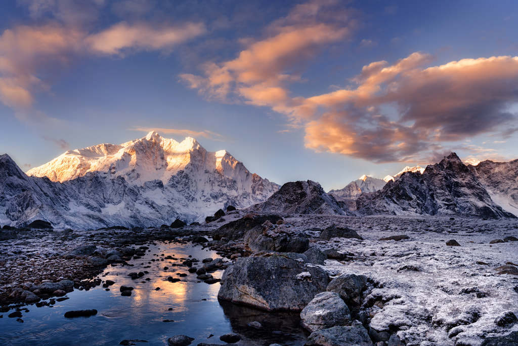
Mount Everest, the highest mountain of Nepal is also the highest mountain peak in the world. It is part of the extensive Mahalangur Himalayan mountain range. Located in the Khumbu region, the mountain was named in remembrance of Sir George Everest. The mountain is popularly called “Sagarmatha” in Nepal and “Chomolungma” in local Sherpa language.
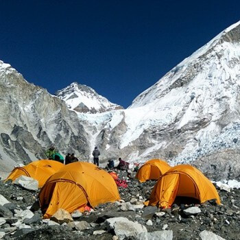
The expedition of Mt. Everest contributes immensely to the tourism industry of the country. The Everest region is incredibly beautiful and is one of the most trekked regions in the world. The immense popularity of the trek has led to the commercialization of trekking journeys and the overall tourism boom in the country.
Climbing the highest mountain in the world is every mountaineer’s dream. Climbers usually use the south route from Nepal to climb Everest. “Sagarmatha” means “the forehead of the sky” in the Nepali language. The mountain was first accented by Sir Edmund Hillary from New Zealand and Tenzing Norgay Sherpa from Nepal on May 29, 1953.
The Mount Everest massif has some of the highest mountains of Nepal, including the Nuptse Himal, Lhotse peak, and Changtse. The high freezing winds of the summit poses a significant threat to climbers. Sherpas are an ethnic community known for their excellent mountain climbing skills.
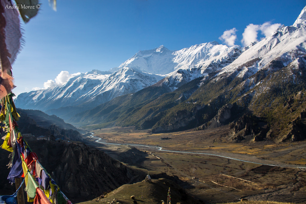
Sherpa settlements across the Khumbu region give you an incredible insight into the local culture and Buddhist heritage. The trails along the Everest region move across the famous landmarks of the Tengboche Monastery, Namche Bazaar, Sagarmatha National Park, Kalapatthar viewpoint, among others.
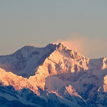
Kanchenjunga
- Elevation: 8,586 m (28,169 ft)
- Geographical location: Northern Kanchenjunga Himalayan mountain range, Taplejung District
- First ascent on 25th May 1995
- First ascent by Gorge Band and Joe Brown
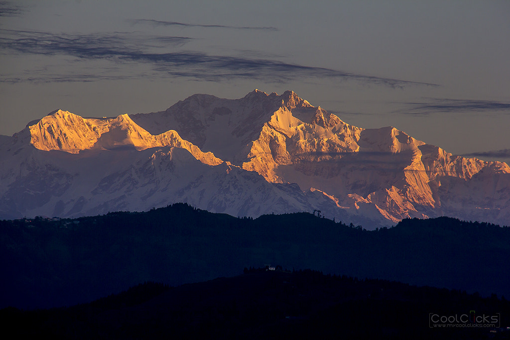
Kanchenjunga is a beautiful massif situated in the south-east of Mount Everest. The third tallest mountain in the world is just 125 kilometers away from Everest. There are five prominent peaks in the massif called the “five treasures of the snow” by the local people.
The Kanchenjunga mountain is also a sacred mountain revered by pilgrims from both Nepal and India. Joe Brown and Gorge Band climbed the mountain for the first time on the 25th May 1995 as a part British expedition team. The word “Kanchenjunga” means the “five repositories of great snow” in the Tibetan language.
The massif provides a watershed or rain shadow to the area. Kanchenjunga looks beautiful and rugged white wall hanging from the sky from the viewpoint of Antu Dada in Ilam. Out of the four climbing routes of Kanchenjunga, three lies in Nepal and one in India. The beautiful Kanchenjunga Conservation Area is another attraction of the region.
Limbu people believe that the omnipotent Goddess Yuma Sammang resides in the Annapurna region. Another myth surrounding the mountain is that of “the Kangchenjunga demon”. The myth states that Kanchenjunga is home to the deity of Dzö-nga. Locals also believe that there are five treasures hidden in the Kanchenjunga mountain slopes. The said treasure is only revealed when the world is in grave peril.
The mythology further states that five treasures of the snow include the salt, gold, sacred scriptures, turquoise, invincible armor, and medicine. The off-the-beaten-paths is perfect for trekkers who want a solitary experience. Overall, the second-highest mountain of Nepal is famous all over the world for its challenging route and incredible height.
Lhotse
- Elevation: 8,516 m (27,940 ft)
- Geographical location: Mahalangur Himalayan mountain range, and the Everest massif
- First ascent on May 18, 1956
- First ascent by Ernst Reiss and Fritz Luchsinger
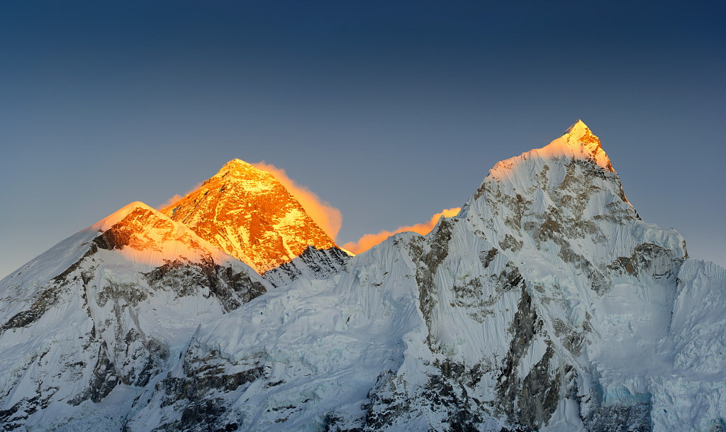
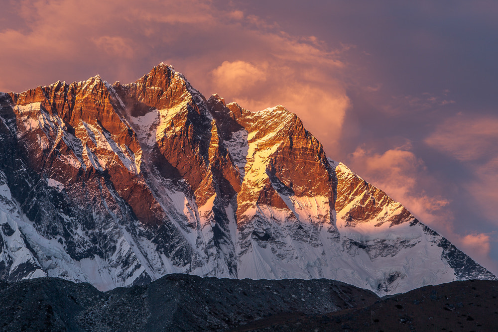
Lhotse, the third highest mountain of Nepal, is also a part of the Mount Everest massif. The name of Lhotse means “the South Peak” in Tibet. There are three prominent peaks of Lhotse. While the main summit is 8,516 m, the Lhotse East is 8,414 m, and Lhotse Shar is 8,383 m.
Lhotse shares the same route as that of Mount Everest and is a popular alternative to the mountain. Ernst Reiss and Fritz Luchsinger from the Swiss mountaineering and Expedition team in 1956 first ascended the mountain. The Lhotse Face boasts of a wall of blue glacial ice.
The Lhotse Shar forms a glacier and adjoins with the Imja Glacier. The climbing route of Lhotse is the same as that of Everest’s South Col route up to the Yellow Band. The routes then diverge after the Yellow Band, as the Everest expedition take a left over the Geneva Spur up to the South Col.
The Lhotse climbers, on the other hand, take a right further up the Lhotse face. Climbers have to face the narrow “Reiss couloir” before arriving at the Lhotse’s main peak.
Makalu
- Elevation: 8,481 m (27,838 ft)
- Geographical location: Makalu Mahalangur Himalayan mountain range, Khumbu region
- First ascent on May 15, 1955
- First ascent by Lionel Terray and Jean Couzy
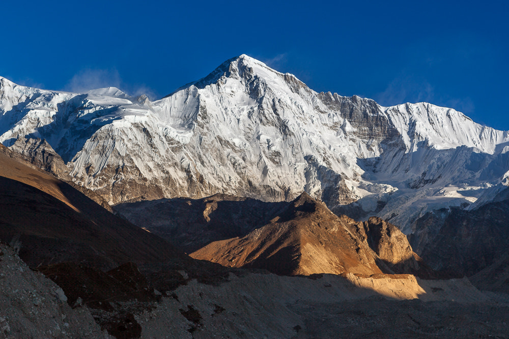
Mount Makalu is the fourth highest mountain of Nepal and the fifth highest mountain in the world. It lies in the south-east of Mount Everest. The mountain lies on the border of China and Nepal and resembles a four-sided pyramid of snow and ice.
The Sanskrit word “Maha Kala” literally means “the great black” in English and denotes the form of Hindu God Shiva. The mountain lies 14 miles or 22 kilometers Rising from the ground Makalu is also known as ‘Kumba Karna’, which means ‘the great sleeping giant’.
The mountain forms two subsidiary peaks of Kangchungtse and the Chomo Lonzo. Chomo Lonzo is two miles away from the Makalu summit and placed over the Kangshung valley in Tibet. Lionel Terray and Jean Couzy climbed on May 15, 1955, and were part of a French expedition.
Makalu is technically harder than most of the eight thousand and above mountains. The gradients are steep, and the open knife-edged ridges are dangerous. The trail to the mountain passes through the beautiful Makalu-Barun Valley. The valley has abundant glaciers and white rivers.
Makalu Barun Valley and Mount Makalu both fall under the conservation area of Makalu Barun National Park. The sanctuary of the Barun valley has plenty of wildlife, including wolves, lynxes, and even snow-leopards. Rare wildlife is active in a unique and isolated habitat.
The off-the-beaten-paths of Mount Makalu receive a fewer number of trekkers and climbers than Everest. The ethnic settlement of Gurung, Rai, and Sherpa community provides an opportunity for rich cultural exploration.
Cho Oyu
- Elevation: 8,188 m (26,864 ft)
- Geographical location: Mahalangur Himalayan Mountain Range, Khumbu region
- First ascent on October 19th, 1954
- First ascent by Pasang Dawa Lama, Herbert Tichy, and Joseph Jöchler.
Mount Cho Oyu lies 20 kilometers west of Mount Everest. The fifth highest mountain of Nepal separates the borders of China and Nepal. The name ‘Cho Oyu’ means ‘Turquoise Goddess’ is the Tibetan language. Locals also refer to the mountain as “the mighty Head of the Goddess”.
In Tibetan terminology, the word Cho Oyu means “the Bald God”. Legend has it that the Bald God- Cho Oyu turned his back to Chomolungma- the goddess Mount Everest as she refused his proposal of marriage. Mount Cho Oyu is one of the most accessible peaks above the westernmost point of Mahalangur Himalayan mountain range.
The Tibetan and Nepali traders used the glaciated high pass to trade in the old days on Yaks and mules. The first ascent of the peak was on October 19th, 1954, by Joseph Jöchler, Herbert Tichy, and Sherpa Pasang Dawa Lama of an Austrian expedition group.
The mountain is extremely popular among mountaineers because of the ease of climb and holds the record of most number of ascends after Mt Everest. The ascent of Cho Oyu via the western face of Tibet is quite popular.
Dhaulagiri I
- Elevation: 8,167 m (26,795 ft)
- Geographical location: Dhaulagiri Himalayan mountain range, Annapurna region
- First ascent on May 13th, 1960
- First ascent by Kurt Diemberger, A. Schelbert, E. Forrer, Nawang Dorje, and Nyima Dorje
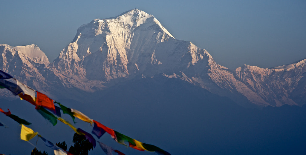
Dhaulagiri I, part of the spectacular Dhaulagiri massif is the sixth highest mountain of Nepal. The word “Dhawala” means “dazzling or beautiful” and “Giri” means “mountain” in the local language. Annapurna I lies 35 km east of Dhaulagiri I meanwhile creating the Kali Gandaki Gorge, which is the deepest gorge in the world.
Along with Dhaulagiri I, the massif contains Dhaulagiri III, IV, V, VI, and VII. The massif also includes Gurja Himal, Churen Himal(primary), Churen Himal(east), Churen Himal (west), the False Junction Peak, Peak Hawley, and the Hiunchuli Patan. The magnificent Dhaulagiri I rises from lower ridges.
The rise from the Kali Gandaki River makes for a spectacular sight. The region is also a rain-shadow zone due to the geographical landscapes of the area and closeness to Mustang and Dolpo. The dry and arid landscapes of Mustang makes for a great off the beaten trekking adventure.
The desert-like terrain of Mustang looks awe-inspiring in contrast to the White Mountain. Mount Dhaulagiri was first climbed on May 13th, 1960, by Kurt Diemberger, E. Forrer, P. Diener, A. Schelbert, Nawang Dorje Sherpa, Nyima Dorje Sherpa who were members of the Swiss-Austrian expedition team.
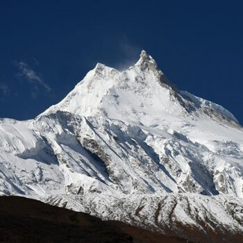
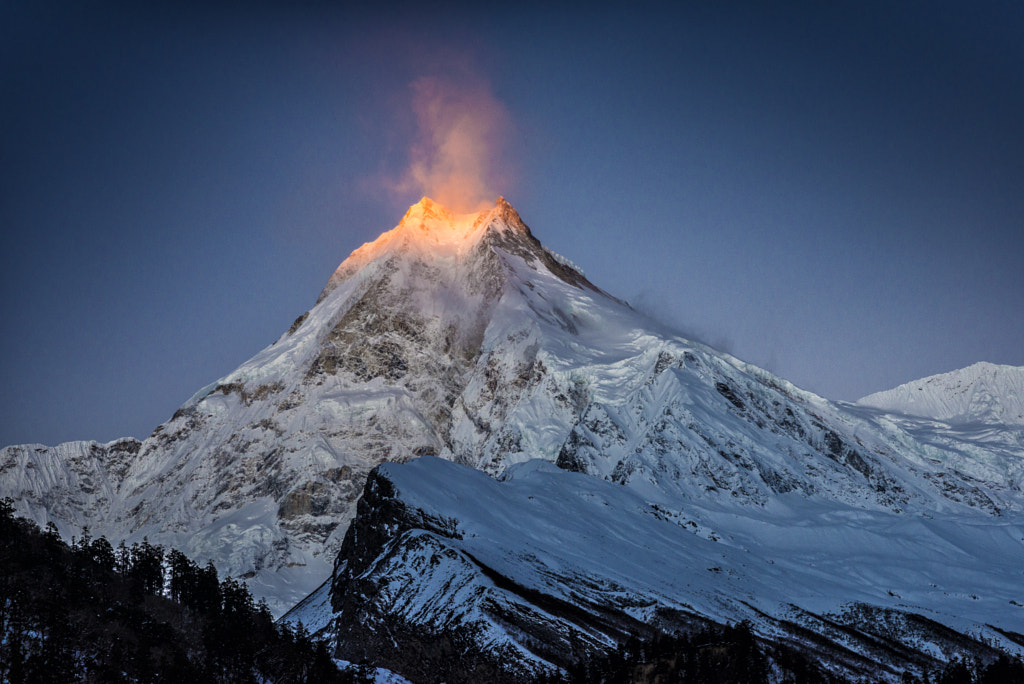
Manaslu
- Elevation: 8,156 m (26,781 ft)
- Geographical location: Mansiri Himalayan mountain range, Gorkha
- First ascent on May 9, 1956
- First ascent by Artur Hajzer, Gyalzen Norbu and Toshio Imanishi
Mount Manaslu, part of the Mansuri Himalayan massif, is the seventh highest mountain of Nepal. The summit is also known as “Kutang” in Tibetan language, meaning “the Mountain of Spirits.” “Manasa” means “intellect” or “soul” in the ancient language of Sanskrit.
The first successful expedition was by Toshio Imanishi, Artur Hajzer and Gyalzen Norbu in 1956. The Japanese Expedition first climbed Mount Manaslu, and since then, Japanese climbers have flocked the mountain. The long ridges and valley glaciers surrounding the Mount Manaslu offer practical approaches from all directions.
The ridges come together to form the majestic peak. A steeply rising slope is the dominant feature of Mount Manaslu. The trekking adventure in the Manaslu region is relatively new and open only since 1991. Traders used the isolated routes of Mount Manaslu for salt trading along the Budhi Gandaki River.
The Larkya La glacial pond is at 5,106 meters also lies north of Manaslu. The mountain is famous for resembling a wall of snow and ice hanging in the sky. The Manaslu mountain range has other highest mountains of Nepal including the Ngadi Chuli, Himalchuli, and the Baudha.
Annapurna I
- Elevation: 8,091 m (26,545 ft)
- Geographical location: Annapurna mountain massif, Annapurna region
- First ascent on 3 June 1950
- First ascent by Maurice Herzog and Louis Lachenal, Lionel Terray, and others
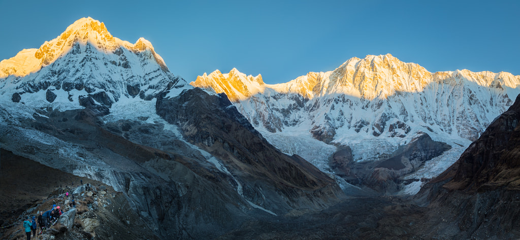
Annapurna I is the tallest mountain in Annapurna mountain massif and the eighth highest mountain in Nepal. It is also the only mountain in the Annapurna massif above the height of 8,000 meters. The Annapurna mountain I is also the last mountain above 8000 meters in Nepal.
There are 13 peaks above 7,000 meters and 16 peaks above 6,000 meters in the Annapurna massif. in Sanskrit, Annapurna literally means “abundance of Food”. According to legends, the mountain is also considered as the “Annapurna Goddess” or the Goddess of “Good fortune and wealth.”
The Swiss climber, Ueli Steck, made a solo ascent through the challenging Lafaille route on 8th and 9th October 2013. He climbed the highest part of Annapurna on his third attempt. This feat is widely considered as one of the most excellent Himalayan climbs in history.
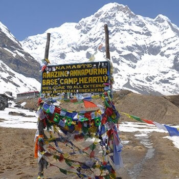
It took Steck 28 hours from Annapurna Base Camp to the summit. He sadly lost his life on April 30th, 2017, while climbing the other Himalayan mountain of Nuptse in Nepal. While not on the list of the highest mountains of Nepal, Nuptse is quite dangerous due to the hollows, and weak snows and cornices.
The Annapurna Conservation Area is an excellent sanctuary for wildlife and nature conservation. The Annapurna Sanctuary conserves the Annapurna region’s magnificent and natural terrains.
Gyachung Kang
- Elevation: 7,957 m (26,089 ft)
- Geographical location: Mahalangur Himalayan range, Khumbu
- First ascent on April 10, 1964
- First ascent by Pasang Phutar Sherpa, Yukihiko Kato, and Kiyoto Sakaizawa
Gyachung Kang is a beautiful mountain peak between Mount Cho Oyu and Mount Everest. The mountain peak is the ninth highest mountain of Nepal and the fifteenth-highest peak in the world.
The relatively obscure mountain was first climbed on April 10, 1964, by Yukihiki Kato, Kiyoto Sakaizawa, and Pasang Phutar from a Japanese expedition team. Gyachung Kang is the tallest peak among the mountains between Cho Oyu and Everest.
A very narrow saddle separates these mountains. Gyachung Kang remains covered in frozen snow and looks astonishingly beautiful. The mountain narrowly misses the 8000 meters mark but still ranks among the top 10 highest mountains of Nepal. The peak lacks the prominence and popularity among its companions due to the height factor.
Annapurna II
- Elevation: 7,937 m (26,04 ft)
- Geographical location: Annapurna Mountain massif, Annapurna region
- First ascent on May 17th, 1960
- First ascent by Chris Bonington, J.O.M. Roberts, Richard Grant, and Sherpa Ang Nyima
The Annapurna II of the Annapurna mountain massif ranks among the top 10 highest mountains of Nepal by a small margin. The 10th highest mountain of Nepal lies in the easternmost part of the Himalayan mountain range. The mountain peak was first ascended by a combined team of British, Indian, and Nepali mountaineers on May 17th, 1960.
The second-highest mountain of the Annapurna Himalayan mountain range is stunning. Only a handful of mountaineers have climbed the mountain peak of Annapurna II. The Annapurna Ii is a favorite among mountaineers in the Annapurna mountain range.
Annapurna I serves as the western anchor of Annapurna II. The peak is in close proximity to Annapurna I Main, but it is fully independent. The 16th highest mountain in the world is popular among climbers as it is a part of the famous Annapurna massif.
Conclusion
Nepal is a Himalayan wonderland. The top 10 highest mountains of Nepal are the crown jewels of the country. The geographical diversity of the tiny Himalayan nation contributes to the natural beauty of Nepal. The multicultural and ethnic landscapes are equally vibrant and appealing.
The highest mountain in the world, Mount Everest and other 8000m and above peaks are present in Nepal. The peak climbing season in Nepal is pretty packed, as there are plenty of options when it comes to climbing. Some sacred mountains are, however, forbidden to climb as it conflicts with the local’s belief.
Trekking to the base camp of these mountains is another popular activity in Nepal. The climbing expedition and trekking activity are at full swing in the peak season of autumn and spring months. The top 10 highest mountains of Nepal are quite famous among adventure enthusiasts all over the world.
Need Help Planning Your Trip to Nepal?
Contact us, if you have any queries planning your trip to Nepal. We will respond to you within 24 hours.